Introduction
AI HD Map Change Detection tools use artificial intelligence, computer vision, geospatial analytics, and sensor data to identify changes in high-definition maps used by autonomous vehicles and advanced driver-assistance systems. These systems can compare newly collected road information with existing map data to detect changes such as new lanes, road closures, construction, changed traffic signs, modified intersections, and altered road geometry.
HD map change detection is especially important because road environments continuously evolve. A map that was accurate when created may become outdated after construction, lane changes, infrastructure modifications, or temporary traffic changes.
Best for: Autonomous-driving companies, automotive OEMs, mapping providers, mobility companies, robotics developers, GIS teams, and organizations maintaining large-scale road networks.
Not ideal for: Small teams that only need basic geographic mapping, simple navigation applications, or occasional manual map updates.
What’s Changed in AI HD Map Change Detection
- AI-based computer vision is increasingly used to compare new imagery with historical map information.
- Multi-sensor fusion can combine cameras, lidar, radar, GNSS, and vehicle telemetry.
- Automated change detection is reducing dependence on completely manual map review.
- Machine learning can prioritize potentially significant changes for human validation.
- Point-cloud comparison is increasingly important for detecting changes in road geometry and infrastructure.
- Semantic segmentation helps distinguish meaningful road changes from environmental noise.
- Automated detection can identify lane markings, traffic signs, barriers, curbs, and road structures.
- Crowdsourced vehicle data can provide frequent updates from large fleets.
- Edge processing can identify potential map changes closer to the point of data collection.
- Cloud-based pipelines enable large-scale comparison across road networks.
- AI systems increasingly need confidence scoring so mapping teams can review uncertain changes.
- Versioned map databases are becoming important for traceability and rollback.
- Scenario-based validation can determine whether a detected change actually affects driving behavior.
- Privacy-preserving processing is increasingly relevant when mapping systems collect imagery from public roads.
- Automation is increasingly being combined with human-in-the-loop validation rather than fully autonomous map publishing.
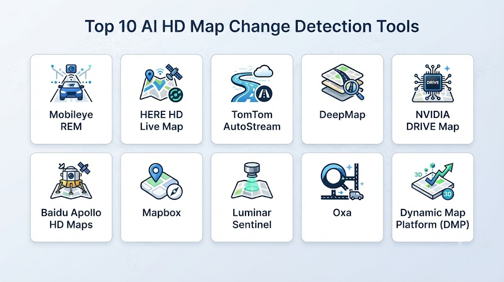
Top 10 AI HD Map Change Detection Tools
1 — HERE HD Live Map
One-line verdict: Best for automotive organizations needing continuously updated high-definition mapping and road-change information.
Short description:
HERE provides high-definition mapping technologies designed for automotive and mobility applications. Its mapping ecosystem combines geographic data, vehicle information, sensor-derived information, and other sources to maintain detailed road information.
Standout Capabilities
- HD mapping
- Road-network data
- Automotive mapping
- Map updates
- Location intelligence
- Dynamic road information
- Fleet data integration
- Navigation support
AI-Specific Depth
- Model support: Proprietary AI and machine-learning capabilities may be used within relevant mapping workflows; exact models are not publicly stated.
- RAG / knowledge integration: N/A.
- Evaluation: Map-quality and change-validation processes.
- Guardrails: Human and automated validation workflows vary.
- Observability: Map-quality and update monitoring varies by product.
Pros
- Strong automotive mapping ecosystem.
- Designed for large geographic datasets.
- Relevant to production vehicle programs.
Cons
- Enterprise-oriented.
- Exact implementation details are not always publicly stated.
- Can require integration with broader HERE technologies.
Security & Compliance
Enterprise security, access controls, privacy, retention, and compliance vary by product and contract.
Deployment & Platforms
- Cloud-based services
- APIs
- Automotive integrations
- Enterprise platforms
Specific deployment options vary.
Integrations & Ecosystem
HERE’s ecosystem can support:
- Automotive systems
- Navigation platforms
- Location APIs
- Fleet data
- Mapping services
- Geospatial applications
Pricing Model
Enterprise/custom pricing.
Best-Fit Scenarios
- Automotive HD maps
- Large-scale map maintenance
- Connected-vehicle applications
2 — TomTom AutoStream
One-line verdict: Best for automotive developers needing cloud-delivered map data and frequently updated road information.
Short description:
TomTom provides automotive mapping technologies including HD map and dynamic map services. Its ecosystem supports developers and automotive organizations working with detailed road information and automated-driving applications.
Standout Capabilities
- HD maps
- Cloud-based map delivery
- Automotive mapping
- Dynamic road information
- Map updates
- Road attributes
- Navigation
- Location services
AI-Specific Depth
- Model support: Proprietary mapping and AI technologies; exact model architecture varies.
- RAG / knowledge integration: N/A.
- Evaluation: Map-quality validation.
- Guardrails: Data-quality and validation controls.
- Observability: Map update and service monitoring varies.
Pros
- Strong automotive mapping expertise.
- Suitable for cloud-connected vehicle applications.
- Large-scale geographic coverage.
Cons
- Enterprise integration can be complex.
- Exact AI architecture is generally not publicly detailed.
- Pricing varies by implementation.
Security & Compliance
Specific security and compliance controls depend on the contracted service.
Deployment & Platforms
- Cloud
- APIs
- Automotive platforms
- Embedded integrations
Integrations & Ecosystem
- Automotive software
- Navigation
- APIs
- Cloud services
- Vehicle systems
- Geospatial applications
Pricing Model
Enterprise/custom pricing.
Best-Fit Scenarios
- Automotive map delivery
- Connected vehicles
- HD mapping
3 — Mobileye REM
One-line verdict: Best for large-scale road mapping using vehicle-generated data and crowdsourced road intelligence.
Short description:
Mobileye REM is a mapping technology that uses data collected from vehicles to create and maintain detailed road information. Its approach is particularly relevant to automated-driving and advanced driver-assistance applications.
Standout Capabilities
- Crowdsourced mapping
- Vehicle-generated data
- Road geometry
- Lane information
- Road infrastructure
- Automated mapping
- Fleet-scale data collection
- ADAS integration
AI-Specific Depth
- Model support: Proprietary AI systems.
- RAG / knowledge integration: N/A.
- Evaluation: Map-data validation and automated processing.
- Guardrails: Data-quality validation.
- Observability: Mapping-data quality and fleet data monitoring vary.
Pros
- Strong connection between vehicles and mapping.
- Designed for large-scale road data.
- Highly relevant to ADAS.
Cons
- Primarily enterprise/automotive oriented.
- Access depends on commercial relationships.
- Proprietary ecosystem.
Security & Compliance
Specific enterprise security, privacy, and retention controls vary.
Deployment & Platforms
- Automotive systems
- Cloud infrastructure
- Vehicle-generated data pipelines
Integrations & Ecosystem
- ADAS systems
- Vehicle sensors
- Fleet data
- Mapping platforms
- Automotive software
- Cloud infrastructure
Pricing Model
Enterprise/custom pricing.
Best-Fit Scenarios
- Fleet-based mapping
- ADAS mapping
- Large-scale road change detection
4 — NVIDIA DRIVE Map
One-line verdict: Best for automotive developers combining AI perception, vehicle sensors, mapping, and NVIDIA accelerated computing.
Short description:
NVIDIA’s automotive ecosystem includes mapping technologies designed to work with autonomous-driving and ADAS development. Its broader platform supports perception, simulation, sensor processing, and map-related workflows.
Standout Capabilities
- Automotive mapping
- Sensor processing
- AI perception
- Autonomous-driving development
- GPU acceleration
- Simulation
- Sensor fusion
- Edge computing
AI-Specific Depth
- Model support: NVIDIA-oriented AI ecosystem.
- RAG / knowledge integration: N/A.
- Evaluation: Simulation and perception evaluation workflows.
- Guardrails: Safety and testing controls vary by implementation.
- Observability: Development and simulation metrics.
Pros
- Strong AI computing ecosystem.
- Integrates well with automotive perception workflows.
- Suitable for high-performance processing.
Cons
- NVIDIA ecosystem dependency.
- Automotive implementation can be complex.
- Exact map-change functionality varies by solution.
Security & Compliance
Specific enterprise controls depend on deployment.
Deployment & Platforms
- Automotive edge
- Cloud
- NVIDIA hardware
- Enterprise development environments
Integrations & Ecosystem
- NVIDIA DRIVE
- GPUs
- AI perception
- Simulation
- Sensor processing
- Automotive software
Pricing Model
Enterprise/custom pricing.
Best-Fit Scenarios
- AI-powered automotive mapping
- Autonomous-driving development
- Sensor-fusion workflows
5 — Mapbox
One-line verdict: Best for developers building customizable location applications and map-based vehicle experiences.
Short description:
Mapbox provides mapping, navigation, geospatial, and location-development technologies. Its platform can be incorporated into automotive and mobility applications requiring map data, navigation, and location intelligence.
Standout Capabilities
- Digital maps
- Navigation
- Geospatial APIs
- Location intelligence
- Map visualization
- Data customization
- Developer APIs
- Automotive applications
AI-Specific Depth
- Model support: AI capabilities vary by product.
- RAG / knowledge integration: N/A.
- Evaluation: Application-specific.
- Guardrails: Platform and API controls vary.
- Observability: API and application monitoring varies.
Pros
- Developer-friendly ecosystem.
- Flexible APIs.
- Strong map visualization capabilities.
Cons
- Not exclusively an HD map change-detection platform.
- Advanced automotive workflows may require additional systems.
- Exact capabilities depend on product configuration.
Security & Compliance
Enterprise security and privacy capabilities vary by service and plan.
Deployment & Platforms
- Cloud
- Web
- Mobile
- APIs
- Automotive integrations
Integrations & Ecosystem
- APIs
- SDKs
- Navigation
- Mobile applications
- Web applications
- Automotive systems
- Geospatial data
Pricing Model
Usage-based and tiered commercial models vary.
Best-Fit Scenarios
- Mobility applications
- Developer mapping
- Location-aware vehicle applications
6 — ArcGIS Pro
One-line verdict: Best for GIS teams performing sophisticated spatial analysis and custom AI-assisted map-change workflows.
Short description:
ArcGIS Pro is a professional GIS application that supports spatial analysis, imagery, 3D data, geoprocessing, and AI-assisted workflows. Organizations can use it as part of custom HD map change-detection pipelines.
Standout Capabilities
- GIS analysis
- Raster analysis
- 3D visualization
- Point-cloud processing
- Spatial analysis
- Image classification
- Geoprocessing
- AI-assisted analysis
AI-Specific Depth
- Model support: Supports machine-learning and deep-learning workflows.
- RAG / knowledge integration: N/A.
- Evaluation: Model and spatial-analysis evaluation.
- Guardrails: User-defined analysis controls.
- Observability: GIS processing and analysis outputs.
Pros
- Powerful geospatial capabilities.
- Strong ecosystem.
- Excellent for custom workflows.
Cons
- Not purpose-built exclusively for automotive HD maps.
- Requires GIS expertise.
- Customization may be necessary.
Security & Compliance
Enterprise GIS security capabilities vary by deployment and organizational configuration.
Deployment & Platforms
- Desktop
- Enterprise
- Cloud-connected workflows
- Windows
Integrations & Ecosystem
- GIS datasets
- Raster data
- Point clouds
- Python
- Machine learning
- Enterprise GIS
- Geospatial databases
Pricing Model
Commercial licensing; exact pricing varies.
Best-Fit Scenarios
- GIS-based map change detection
- Point-cloud analysis
- Geospatial AI
7 — Google Earth Engine
One-line verdict: Best for large-scale satellite and geospatial analysis where road-change detection can be built using custom machine-learning workflows.
Short description:
Google Earth Engine provides large-scale geospatial analysis capabilities using extensive satellite and Earth-observation datasets. It can support custom change-detection workflows, although it is not specifically an automotive HD map platform.
Standout Capabilities
- Satellite imagery
- Geospatial analysis
- Time-series comparison
- Machine learning
- Large-scale processing
- Raster analysis
- Environmental monitoring
- Change detection
AI-Specific Depth
- Model support: Supports custom machine-learning workflows.
- RAG / knowledge integration: N/A.
- Evaluation: Custom model evaluation.
- Guardrails: Access and platform controls.
- Observability: Processing and analytical outputs.
Pros
- Excellent large-scale geospatial processing.
- Extensive Earth-observation datasets.
- Strong research capabilities.
Cons
- Not specifically designed for HD automotive maps.
- Satellite resolution may not be sufficient for every road-level task.
- Custom engineering is required.
Security & Compliance
Enterprise controls vary according to the deployment and account configuration.
Deployment & Platforms
- Cloud
- Web
- APIs
- Development environments
Integrations & Ecosystem
- Satellite imagery
- Geospatial datasets
- Machine learning
- APIs
- Cloud computing
- GIS workflows
Pricing Model
Pricing and availability depend on usage and organizational context.
Best-Fit Scenarios
- Large-scale road monitoring
- Geospatial research
- Historical change analysis
8 — OpenStreetMap + Mapillary
One-line verdict: Best for open mapping communities and developers combining crowdsourced imagery with continuously evolving geographic data.
Short description:
OpenStreetMap provides an open geographic database, while Mapillary provides crowdsourced street-level imagery. Together, they can support custom road-change detection workflows using imagery, map data, and computer vision.
Standout Capabilities
- Crowdsourced mapping
- Street-level imagery
- Geographic data
- Computer vision
- Map editing
- Road-feature detection
- Community contributions
- Open-data workflows
AI-Specific Depth
- Model support: Custom computer-vision models can be integrated.
- RAG / knowledge integration: N/A.
- Evaluation: Custom evaluation.
- Guardrails: Community and platform policies.
- Observability: Custom pipelines.
Pros
- Flexible open-data ecosystem.
- Useful for experimentation.
- Large community involvement.
Cons
- Not a complete commercial HD map-change platform.
- Data quality can vary.
- Production workflows require engineering and validation.
Security & Compliance
Security and compliance depend on the individual services and deployment architecture.
Deployment & Platforms
- Web
- APIs
- Cloud
- Developer applications
Integrations & Ecosystem
- OpenStreetMap
- Mapillary
- Computer vision
- GIS tools
- APIs
- Python
- Geospatial databases
Pricing Model
Open-data components and commercial services may coexist; exact costs vary.
Best-Fit Scenarios
- Research
- Crowdsourced mapping
- Custom change detection
9 — Hexagon Geospatial
One-line verdict: Best for enterprise geospatial organizations managing complex imagery, mapping, and spatial-data analysis workflows.
Short description:
Hexagon provides geospatial technologies for mapping, imagery, surveying, and spatial intelligence. Its ecosystem can support organizations developing automated map-change detection workflows from imagery and geospatial data.
Standout Capabilities
- Geospatial analytics
- Remote sensing
- Image processing
- 3D data
- Mapping
- Surveying
- Spatial intelligence
- Data management
AI-Specific Depth
- Model support: AI and machine-learning capabilities vary by product.
- RAG / knowledge integration: N/A.
- Evaluation: Application-specific.
- Guardrails: Enterprise workflow controls vary.
- Observability: Data and processing monitoring varies.
Pros
- Strong geospatial expertise.
- Enterprise-grade ecosystem.
- Supports complex spatial workflows.
Cons
- May require specialized expertise.
- Not specifically focused on automotive HD maps.
- Enterprise implementation can be complex.
Security & Compliance
Security and compliance capabilities vary by product and deployment.
Deployment & Platforms
- Desktop
- Enterprise
- Cloud
- Hybrid environments
Integrations & Ecosystem
- GIS
- Remote sensing
- Surveying
- Point clouds
- Imagery
- APIs
- Enterprise databases
Pricing Model
Enterprise/custom pricing.
Best-Fit Scenarios
- Enterprise mapping
- Geospatial analytics
- Large imagery datasets
10 — Bentley Systems iTwin
One-line verdict: Best for digital-twin workflows where infrastructure and roadway changes need to be detected and represented spatially.
Short description:
Bentley Systems provides digital-twin technologies for infrastructure and engineering. Its iTwin ecosystem can help organizations represent, analyze, and manage changes across physical infrastructure environments.
Standout Capabilities
- Digital twins
- 3D visualization
- Infrastructure data
- Geospatial information
- Change analysis
- Engineering data
- Asset management
- Cloud collaboration
AI-Specific Depth
- Model support: AI capabilities vary by product and implementation.
- RAG / knowledge integration: N/A.
- Evaluation: Application-specific.
- Guardrails: Enterprise controls vary.
- Observability: Infrastructure data and digital-twin monitoring.
Pros
- Strong infrastructure focus.
- Useful for roadway and asset environments.
- Digital-twin capabilities can provide rich context.
Cons
- Not designed exclusively for automotive HD maps.
- Requires engineering and infrastructure expertise.
- May need custom AI components for automated detection.
Security & Compliance
Enterprise security and compliance capabilities vary by product and deployment.
Deployment & Platforms
- Cloud
- Web
- Enterprise
- APIs
Integrations & Ecosystem
- Digital twins
- Engineering models
- GIS
- Infrastructure datasets
- APIs
- 3D models
- Cloud platforms
Pricing Model
Enterprise/custom pricing.
Best-Fit Scenarios
- Road infrastructure monitoring
- Digital twins
- Infrastructure change analysis
Comparison Table
| Tool | Best For | Deployment | Model Flexibility | Strength | Watch-Out | Public Rating |
|---|---|---|---|---|---|---|
| HERE HD Live Map | Automotive HD mapping | Cloud/Automotive | Proprietary | Automotive mapping | Enterprise integration | |
| TomTom AutoStream | Dynamic automotive maps | Cloud/Automotive | Proprietary | Map delivery | Commercial integration | |
| Mobileye REM | Fleet-generated maps | Automotive/Cloud | Proprietary | Crowdsourced mapping | Proprietary ecosystem | |
| NVIDIA DRIVE Map | AI automotive systems | Cloud/Edge | NVIDIA ecosystem | AI + automotive computing | Hardware dependency | |
| Mapbox | Developer mapping | Cloud/API | Flexible | Developer ecosystem | Not exclusively HD maps | |
| ArcGIS Pro | GIS analysis | Desktop/Enterprise | Flexible | Spatial analytics | Requires GIS expertise | |
| Google Earth Engine | Large-scale geospatial analysis | Cloud | Flexible | Earth observation | Not HD-map specific | |
| OpenStreetMap + Mapillary | Open mapping | Web/Cloud | Open/custom | Crowdsourced data | Variable data quality | |
| Hexagon Geospatial | Enterprise geospatial workflows | Cloud/Enterprise | Flexible | Spatial intelligence | Implementation complexity | |
| Bentley iTwin | Infrastructure digital twins | Cloud | Flexible | Infrastructure context | Requires customization |
Scoring & Evaluation
The following scores are comparative editorial assessments rather than official vendor scores. They reflect suitability for HD map change-detection workflows, ecosystem maturity, flexibility, and enterprise usability.
| Tool | Core | Reliability/Eval | Guardrails | Integrations | Ease | Perf/Cost | Security/Admin | Support | Weighted Total |
|---|---|---|---|---|---|---|---|---|---|
| HERE HD Live Map | 10 | 9 | 9 | 10 | 8 | 8 | 9 | 10 | 9.15 |
| TomTom AutoStream | 10 | 9 | 9 | 10 | 8 | 8 | 9 | 10 | 9.15 |
| Mobileye REM | 10 | 10 | 9 | 9 | 7 | 9 | 9 | 10 | 9.15 |
| NVIDIA DRIVE Map | 9 | 9 | 9 | 10 | 7 | 9 | 9 | 10 | 9.00 |
| Mapbox | 8 | 8 | 8 | 10 | 9 | 9 | 9 | 10 | 8.85 |
| ArcGIS Pro | 9 | 9 | 8 | 10 | 8 | 8 | 9 | 10 | 8.85 |
| Google Earth Engine | 8 | 9 | 8 | 9 | 8 | 9 | 9 | 10 | 8.75 |
| OpenStreetMap + Mapillary | 8 | 7 | 7 | 10 | 8 | 10 | 7 | 9 | 8.15 |
| Hexagon Geospatial | 9 | 9 | 9 | 9 | 7 | 8 | 9 | 10 | 8.80 |
| Bentley iTwin | 8 | 8 | 8 | 9 | 8 | 8 | 9 | 10 | 8.45 |
Top 3 for Enterprise
- HERE HD Live Map
- TomTom AutoStream
- Mobileye REM
Top 3 for SMB
- Mapbox
- OpenStreetMap + Mapillary
- ArcGIS Pro
Top 3 for Developers
- Mapbox
- OpenStreetMap + Mapillary
- Google Earth Engine
Which AI HD Map Change Detection Tool Is Right for You?
Solo / Freelancer
Developers building prototypes should prioritize accessible APIs, open datasets, computer-vision compatibility, and flexible geospatial tooling.
OpenStreetMap + Mapillary can be an attractive starting point, while Mapbox can simplify application development. Google Earth Engine is useful when historical imagery and large-scale geospatial analysis are important.
SMB
Small companies should avoid building an entire mapping stack from scratch unless map technology is their core product.
Prioritize:
- APIs
- Existing map datasets
- Computer-vision integration
- Automated change detection
- Simple deployment
- Data export
- Reasonable infrastructure costs
Mid-Market
Mid-market automotive and mobility companies should consider a combination of commercial map data and custom AI detection.
A practical architecture may combine:
Vehicle imagery → AI detection → Change candidate → Map database → Human review → Published map version
Enterprise
Large automotive organizations should evaluate full map ecosystems rather than isolated AI models.
Important requirements include:
- Fleet-scale data ingestion
- Automated change detection
- Sensor fusion
- HD map versioning
- Quality control
- Human review
- Geographic scalability
- Real-time or near-real-time updates
- Data governance
- Security
- API availability
Regulated Industries
Organizations operating in safety-sensitive environments should maintain strong traceability.
Important controls include:
- Map version history
- Data provenance
- Review records
- Change approval
- Model versioning
- Audit trails
- Access control
- Data-retention policies
- Incident investigation
Budget vs Premium
Open-source and general-purpose GIS tools can reduce licensing costs but increase internal engineering requirements.
Premium automotive mapping platforms are more attractive when organizations need:
- Global coverage
- Automotive-grade data
- Fleet-scale updates
- Production support
- High-frequency updates
- Commercial SLAs
Build vs Buy
Build when your organization has unique vehicle sensor data, proprietary detection algorithms, or specialized mapping requirements.
Buy when maintaining global map coverage, data collection, infrastructure, and update pipelines would create excessive operational complexity.
A hybrid model is often practical: purchase base map data while building proprietary AI models for change detection and prioritization.
Implementation Playbook
30 Days: Pilot + Success Metrics
- Define the geographic pilot area.
- Select an existing HD map version.
- Collect current road imagery or sensor data.
- Establish a historical comparison dataset.
- Define change categories.
- Build a basic detection pipeline.
- Establish confidence thresholds.
- Create a human-review workflow.
- Measure false positives and false negatives.
Useful metrics include:
- Change-detection precision
- Change-detection recall
- Time to identify changes
- Review time
- Map-update latency
- False-positive rate
- Geographic coverage
60 Days: Harden Security + Evaluation + Rollout
- Add multiple geographic regions.
- Test different weather conditions.
- Evaluate construction zones.
- Add road-geometry changes.
- Test lane changes.
- Add traffic-sign changes.
- Introduce automated regression testing.
- Version models and datasets.
- Add data lineage.
- Implement access controls.
- Validate privacy practices.
90 Days: Optimize Cost + Latency + Governance
- Automate ingestion.
- Optimize AI inference.
- Prioritize high-confidence changes.
- Add active-learning loops.
- Automate human-review queues.
- Introduce map-quality dashboards.
- Monitor model drift.
- Establish governance policies.
- Integrate map publishing workflows.
- Continuously evaluate newly detected changes.
Common Mistakes & How to Avoid Them
- Treating every visual difference as a map change: Environmental conditions can create false positives.
- Ignoring temporary changes: Construction and temporary road closures require separate classification.
- Using outdated reference maps: Detection quality depends heavily on the baseline map.
- Ignoring sensor calibration: Misalignment can appear as geographic change.
- Using only imagery: Combine multiple sensor sources when precision requirements justify it.
- Skipping human validation: Important changes should generally receive appropriate review.
- Ignoring confidence scores: Low-confidence detections need different handling from high-confidence changes.
- Failing to maintain map versions: Always preserve historical versions for investigation and rollback.
- Ignoring geographic variation: Models trained in one region may perform differently elsewhere.
- Ignoring seasonal changes: Weather and vegetation can affect visual comparisons.
- Overlooking privacy: Street-level imagery may contain people, vehicles, or other sensitive information.
- Not tracking model versions: A detected change should be traceable to the model and dataset that produced it.
- Optimizing only for detection accuracy: Update latency and operational review costs also matter.
- Publishing changes without validation: Automated detection should not automatically mean automatic map publication.
FAQs
What is AI HD map change detection?
It is the use of AI, computer vision, geospatial analysis, and sensor data to identify differences between an existing HD map and newly collected road information.
What types of changes can AI detect?
Systems can potentially identify changes involving lanes, road geometry, traffic signs, traffic lights, barriers, curbs, intersections, road construction, and other infrastructure.
Why are HD maps important for autonomous vehicles?
HD maps provide detailed information about road geometry and infrastructure that can complement onboard perception and localization systems.
Can cameras be used for HD map change detection?
Yes. Camera imagery can be analyzed with computer-vision models to identify road features and compare them against existing map information.
Can lidar be used for map change detection?
Yes. Lidar provides 3D point-cloud information that can be particularly useful for detecting changes in road geometry and physical infrastructure.
Is AI enough to automatically update an HD map?
Not necessarily. Production systems generally need confidence scoring, validation, quality controls, and appropriate human review before important changes are published.
What is crowdsourced mapping?
Crowdsourced mapping uses data collected from many vehicles, users, sensors, or other contributors to identify and update geographic information.
Can synthetic data help with HD map change detection?
Synthetic data can help test algorithms against controlled scenarios, but real-world geographic data remains important for validating production performance.
What is point-cloud change detection?
It involves comparing 3D point-cloud data collected at different times to identify physical differences in the environment.
How frequently should HD maps be updated?
There is no universal frequency. It depends on the geographic area, road-change rate, vehicle requirements, data availability, and safety objectives.
Should companies build or buy HD map change detection?
Companies with specialized vehicle data and strong AI teams may benefit from building proprietary detection systems. Others may find commercial map platforms more practical.
Can open-source tools be used?
Yes. Open mapping, GIS, computer-vision, and geospatial tools can provide building blocks for custom solutions, although production validation requires additional work.
How should map-change AI models be evaluated?
Evaluate precision, recall, false positives, false negatives, geographic coverage, environmental robustness, detection latency, and the operational cost of human review.
Does HD map change detection replace vehicle perception?
No. HD maps and onboard perception serve complementary purposes. A vehicle should not necessarily depend on map data for every environmental observation.
What is the biggest challenge in HD map change detection?
One of the biggest challenges is distinguishing meaningful permanent changes from temporary or irrelevant visual differences while maintaining high geographic coverage.
Conclusion
AI HD Map Change Detection is becoming increasingly important as connected vehicles, ADAS, and autonomous-driving systems require road information that remains accurate as the physical environment changes.Commercial automotive mapping platforms such as HERE HD Live Map, TomTom AutoStream, and Mobileye REM are strong options for organizations looking for established automotive mapping ecosystems. NVIDIA is attractive for teams building AI-heavy automotive computing pipelines, while ArcGIS Pro, Google Earth Engine, Mapbox, and open mapping technologies can provide flexible building blocks for custom workflows.The strongest approach is rarely just an AI model. A reliable production architecture connects: