Introduction
Autonomous drone navigation software enables unmanned aerial vehicles to understand their surroundings, estimate their position, plan routes, avoid obstacles, and execute missions with limited human intervention. Modern systems combine flight-control software, GPS/GNSS, computer vision, sensor fusion, mapping, path planning, machine learning, and increasingly AI-based perception and decision-making.
These technologies are useful for inspection, surveying, agriculture, infrastructure monitoring, mapping, emergency response, logistics research, environmental monitoring, and industrial operations. The most capable platforms can combine cameras, LiDAR, inertial sensors, GNSS, and other data sources to help drones operate in environments where GPS may be unreliable or where predefined routes are insufficient.
Best for: Drone manufacturers, robotics engineers, aerospace teams, research organizations, surveying companies, industrial inspection providers, agricultural technology companies, and developers building autonomous UAV applications.
Not ideal for: Basic recreational drones, simple waypoint missions, or operations where manual piloting and conventional GPS-based navigation already provide sufficient reliability.
What to Evaluate
- Autonomous flight capabilities.
- Flight-controller compatibility.
- GPS/GNSS support.
- GPS-denied navigation.
- Visual-inertial odometry.
- SLAM capabilities.
- Obstacle detection.
- Path planning.
- Sensor fusion.
- Computer vision.
- AI model support.
- Edge inference.
- Real-time performance.
- Simulation.
- ROS/ROS 2 compatibility.
- MAVLink support.
- Hardware compatibility.
- Safety mechanisms.
- Geofencing.
- Logging and observability.
- Fleet integration.
- APIs and SDKs.
- Cybersecurity.
- Regulatory requirements.
What’s Changed in Autonomous Drone Navigation Software
- AI perception is becoming more capable: Drones can increasingly use cameras and other sensors to recognize terrain, obstacles, landing areas, objects, and environmental conditions.
- GPS-denied navigation is receiving greater attention: Visual-inertial systems, LiDAR, and SLAM can help drones navigate where GNSS is unavailable or unreliable.
- Edge AI is increasingly important: Navigation decisions often need predictable low latency, making onboard inference more practical than cloud-only processing.
- Sensor fusion is becoming more sophisticated: Combining GNSS, IMU, cameras, LiDAR, barometers, and other sensors can improve localization robustness.
- Autonomous obstacle avoidance is expanding: Modern systems can react to dynamic and static obstacles rather than simply following predefined waypoints.
- Simulation is becoming a core development tool: Developers increasingly test autonomy in simulated environments before exposing aircraft to real-world conditions.
- Multimodal AI is entering drone development: Vision, telemetry, maps, mission information, and natural-language interfaces can potentially be combined for higher-level mission management.
- Model evaluation is becoming essential: AI navigation systems must be evaluated across weather, lighting, terrain, altitude, speed, sensor failures, and unexpected objects.
- Safety architectures are becoming more layered: AI-based navigation should operate alongside deterministic flight-control, failsafe, geofencing, and recovery mechanisms.
- Autonomous mission planning is expanding: Systems increasingly combine route planning with environmental information and mission objectives.
- Cloud-edge architectures are becoming common: Heavy analytics can run in the cloud while time-sensitive navigation remains onboard.
- Fleet-level autonomy is growing: Enterprises increasingly need centralized mission planning, monitoring, telemetry, software updates, and drone health management.
- Cybersecurity is becoming a core requirement: Connected drones introduce risks involving command links, telemetry, firmware, APIs, and mission data.
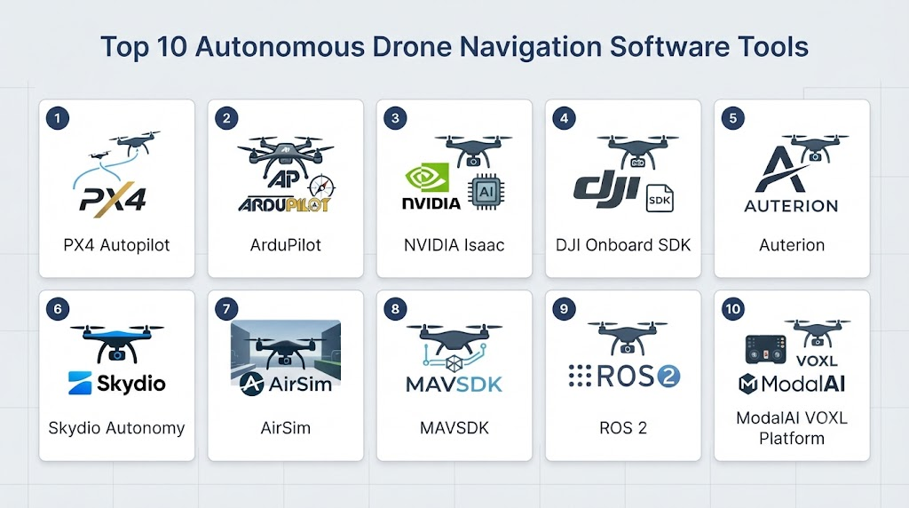
Top 10 Autonomous Drone Navigation Software Tools
1. PX4 Autopilot
One-line verdict: Best for developers building highly customizable autonomous UAVs with open flight-control software and advanced robotics integrations.
Short description:
PX4 is an open-source flight-control platform widely used for autonomous aircraft development, research, and commercial UAV systems. It provides flight-control functionality while supporting integrations with companion computers, sensors, simulation platforms, and robotics frameworks.
Standout Capabilities
- Autonomous flight.
- Mission planning.
- Position control.
- Flight stabilization.
- Sensor integration.
- MAVLink communication.
- Simulation support.
- Companion-computer integration.
AI-Specific Depth
- Model support: External AI models can run on companion computers or integrated computing platforms.
- RAG / knowledge integration: N/A.
- Evaluation: Strong simulation and robotics testing ecosystem.
- Guardrails: Flight failsafes and deterministic control mechanisms complement AI systems.
- Observability: Flight logs and telemetry support debugging and evaluation.
Pros
- Open-source and highly customizable.
- Large UAV development ecosystem.
- Strong robotics and simulation integrations.
Cons
- Requires engineering expertise.
- AI capabilities generally require additional components.
- Production deployment requires extensive testing.
Security & Compliance
Security depends on the aircraft architecture, communication links, firmware configuration, companion computer, and deployment environment. Regulatory compliance depends on the actual aircraft and operating jurisdiction.
Deployment & Platforms
- Embedded flight controllers: Yes.
- Linux companion computers: Yes.
- Simulation: Yes.
- Cloud: Primarily through external systems.
Integrations & Ecosystem
- MAVLink.
- ROS 2.
- Gazebo.
- NVIDIA platforms.
- Companion computers.
- GNSS.
- Cameras and sensors.
Pricing Model
Open-source software.
Best-Fit Scenarios
- Autonomous drone development.
- Research UAVs.
- Custom commercial drones.
2. ArduPilot
One-line verdict: Best for flexible autonomous UAV development supporting a broad range of aircraft and advanced mission automation.
Short description:
ArduPilot is an open-source autopilot ecosystem supporting multicopters, fixed-wing aircraft, rovers, boats, and other vehicles. It provides autonomous flight functionality and can be combined with companion computers and AI systems for advanced UAV applications.
Standout Capabilities
- Autonomous missions.
- Waypoint navigation.
- Multiple vehicle types.
- Sensor integration.
- Mission planning.
- Telemetry.
- Geofencing.
- Companion-computer support.
AI-Specific Depth
- Model support: External AI models can be integrated through companion computers and APIs.
- RAG / knowledge integration: N/A.
- Evaluation: Simulation and flight-log analysis support testing.
- Guardrails: Extensive flight-control and failsafe functionality; AI safety requires additional system design.
- Observability: Detailed telemetry and flight logs.
Pros
- Extremely flexible.
- Supports many vehicle configurations.
- Large open-source community.
Cons
- Configuration can be complex.
- AI capabilities require external integration.
- Production systems require careful validation.
Security & Compliance
Depends on hardware, communication architecture, firmware configuration, and operating environment.
Deployment & Platforms
- Embedded: Yes.
- Companion computers: Yes.
- Simulation: Yes.
- Ground-control systems: Supported through ecosystem tools.
Integrations & Ecosystem
- MAVLink.
- Mission Planner.
- ROS.
- ROS 2.
- Companion computers.
- Cameras.
- GNSS.
- Telemetry systems.
Pricing Model
Open-source.
Best-Fit Scenarios
- Custom autonomous UAVs.
- Research.
- Multi-platform drone projects.
3. NVIDIA Isaac ROS
One-line verdict: Best for AI-powered drone perception, localization, navigation, and accelerated robotics workloads on NVIDIA hardware.
Short description:
NVIDIA Isaac ROS provides robotics software packages designed to accelerate perception, navigation, and other robotics workloads. It is particularly relevant to autonomous drone developers using NVIDIA edge computing hardware and ROS 2-based architectures.
Standout Capabilities
- AI perception.
- GPU acceleration.
- ROS 2 integration.
- Visual perception.
- Localization.
- Sensor processing.
- Image processing.
- Robotics acceleration.
AI-Specific Depth
- Model support: NVIDIA-supported and external AI models can be integrated depending on the workload.
- RAG / knowledge integration: N/A.
- Evaluation: ROS 2 and simulation workflows can support evaluation.
- Guardrails: Robotics safety must be implemented at the system level.
- Observability: ROS 2 telemetry, logs, and profiling tools can support monitoring.
Pros
- Strong GPU acceleration.
- Excellent fit for AI robotics.
- Strong ROS 2 ecosystem.
Cons
- NVIDIA hardware may be required for many acceleration scenarios.
- Requires robotics engineering expertise.
- Not a complete drone flight controller by itself.
Security & Compliance
Depends on the deployment architecture, operating system, hardware, communications, and application.
Deployment & Platforms
- Edge: Yes.
- Embedded: Yes.
- Linux: Yes.
- ROS 2: Yes.
- Drone flight control: Requires integration with a flight controller.
Integrations & Ecosystem
- ROS 2.
- NVIDIA Jetson.
- PX4.
- Cameras.
- LiDAR.
- AI models.
- Robotics simulation.
Pricing Model
Software availability varies by component; hardware and commercial infrastructure costs vary.
Best-Fit Scenarios
- AI drone perception.
- Autonomous UAV research.
- Edge computer vision.
4. Auterion
One-line verdict: Best for enterprise and commercial drone operations requiring integrated autonomy, fleet management, and UAV software infrastructure.
Short description:
Auterion provides an operating-system and software ecosystem for commercial drones and autonomous aircraft. Its platform is designed to connect aircraft, autonomy capabilities, mission management, and fleet-level operations.
Standout Capabilities
- Drone operating systems.
- Autonomous flight.
- Fleet management.
- Mission management.
- Remote operations.
- Payload integration.
- Cloud connectivity.
- Enterprise drone workflows.
AI-Specific Depth
- Model support: AI integrations depend on the aircraft and application architecture.
- RAG / knowledge integration: N/A.
- Evaluation: Mission and operational data can support testing and analysis.
- Guardrails: Safety and operational controls depend on the complete deployment.
- Observability: Telemetry and fleet-level monitoring capabilities.
Pros
- Strong commercial drone focus.
- Fleet-oriented architecture.
- Designed for enterprise deployments.
Cons
- Commercial platform.
- Advanced customization may require specialized integration.
- Capabilities depend on supported aircraft and ecosystem.
Security & Compliance
Enterprise security and compliance capabilities vary by product and deployment. Specific certifications should be verified for the exact service and configuration.
Deployment & Platforms
- Aircraft: Yes.
- Edge: Yes.
- Cloud: Yes.
- Fleet management: Yes.
Integrations & Ecosystem
- Commercial drones.
- Flight controllers.
- Payloads.
- Mission systems.
- Cloud services.
- APIs.
- Ground-control applications.
Pricing Model
Commercial and enterprise-oriented; exact pricing is not publicly stated.
Best-Fit Scenarios
- Commercial drone fleets.
- Enterprise inspection.
- Autonomous UAV operations.
5. DJI FlightHub 2
One-line verdict: Best for organizations operating DJI drone fleets requiring centralized mission planning, collaboration, and operational monitoring.
Short description:
DJI FlightHub 2 is a cloud-oriented drone operations platform designed to help organizations manage drone missions, data, teams, and aircraft workflows. It is particularly relevant to commercial operators already using compatible DJI hardware.
Standout Capabilities
- Fleet operations.
- Mission planning.
- Mapping workflows.
- Live flight information.
- Team collaboration.
- Drone data management.
- Remote operational visibility.
- DJI ecosystem integration.
AI-Specific Depth
- Model support: AI capabilities vary by DJI hardware and software ecosystem.
- RAG / knowledge integration: N/A.
- Evaluation: Operational data can support mission review.
- Guardrails: Flight safety depends on aircraft and operational configuration.
- Observability: Telemetry and mission monitoring.
Pros
- Strong DJI ecosystem integration.
- Useful for centralized operations.
- Suitable for commercial drone teams.
Cons
- DJI ecosystem dependence.
- Not designed as a general-purpose AI robotics framework.
- Advanced autonomy depends on compatible hardware and software.
Security & Compliance
Capabilities vary by service and deployment. Organizations with sensitive operational data should evaluate data handling and regional requirements carefully.
Deployment & Platforms
- Cloud: Yes.
- Web: Yes.
- Mobile/field operations: Supported workflows vary.
- DJI drones: Yes.
Integrations & Ecosystem
- DJI aircraft.
- DJI payloads.
- Mapping workflows.
- Mission planning.
- Cloud services.
- Operational data.
Pricing Model
Commercial service; exact pricing varies by plan and deployment.
Best-Fit Scenarios
- DJI enterprise fleets.
- Infrastructure inspection.
- Survey operations.
6. ROS 2
One-line verdict: Best for developers building custom autonomous drone systems combining navigation, perception, planning, and AI.
Short description:
ROS 2 provides a modular robotics middleware environment that allows developers to combine drone sensors, navigation algorithms, AI models, flight controllers, simulation environments, and external applications.
Standout Capabilities
- Sensor integration.
- Distributed robotics.
- Navigation.
- Computer vision.
- AI integration.
- Simulation.
- Multi-node architectures.
- Real-time-oriented workflows.
AI-Specific Depth
- Model support: Broad integration through external AI frameworks.
- RAG / knowledge integration: Possible through application-level components.
- Evaluation: Simulation, automated testing, and robotics logging.
- Guardrails: Must be designed into the complete system.
- Observability: Strong logging and telemetry ecosystem.
Pros
- Highly customizable.
- Large robotics ecosystem.
- Strong AI integration.
Cons
- High engineering requirements.
- Not a complete drone autopilot.
- Safety requires specialized system design.
Security & Compliance
Depends on middleware configuration, networking, hardware, and deployment architecture.
Deployment & Platforms
- Linux: Yes.
- Embedded: Yes.
- Edge: Yes.
- Cloud: Possible.
- Drone: Through flight-controller integration.
Integrations & Ecosystem
- PX4.
- ArduPilot.
- Gazebo.
- NVIDIA platforms.
- Cameras.
- LiDAR.
- AI frameworks.
Pricing Model
Open-source.
Best-Fit Scenarios
- Research drones.
- Custom autonomous navigation.
- Advanced robotics development.
7. Gazebo
One-line verdict: Best for simulating autonomous drone navigation, sensors, environments, and robotic behaviors before real-world deployment.
Short description:
Gazebo is an open-source robotics simulation platform used to test robotic systems in virtual environments. Drone developers can use simulation to evaluate navigation algorithms, sensors, controllers, and autonomous behaviors before conducting physical flight tests.
Standout Capabilities
- Physics simulation.
- Sensor simulation.
- 3D environments.
- Robotics testing.
- ROS 2 integration.
- Autonomous navigation testing.
- Simulation-based evaluation.
- Algorithm validation.
AI-Specific Depth
- Model support: External AI models can be integrated into simulated robotics workflows.
- RAG / knowledge integration: N/A.
- Evaluation: Strong simulation-based evaluation.
- Guardrails: Simulation can test failure scenarios but does not replace real-world safety systems.
- Observability: Simulation telemetry and ROS tooling.
Pros
- Open-source.
- Useful for safe testing.
- Strong robotics ecosystem.
Cons
- Simulation-to-real differences remain important.
- Requires technical expertise.
- Does not directly operate a production drone by itself.
Security & Compliance
Primarily dependent on the surrounding development environment.
Deployment & Platforms
- Linux: Strong support.
- Simulation: Yes.
- ROS 2: Yes.
- Cloud: Possible depending on infrastructure.
Integrations & Ecosystem
- ROS 2.
- PX4.
- ArduPilot.
- Cameras.
- LiDAR.
- IMUs.
- AI models.
Pricing Model
Open-source.
Best-Fit Scenarios
- Autonomous navigation testing.
- AI drone research.
- Simulation-based development.
8. AirSim
One-line verdict: Best for developers researching autonomous aerial systems, computer vision, reinforcement learning, and simulation-based navigation.
Short description:
AirSim is a simulator designed for autonomous vehicles and robotics research. It has been used for testing aerial vehicle navigation, computer vision, machine learning, and reinforcement-learning approaches in simulated environments.
Standout Capabilities
- Drone simulation.
- Computer vision.
- Sensor simulation.
- Reinforcement learning research.
- Autonomous navigation.
- Environment simulation.
- Algorithm testing.
AI-Specific Depth
- Model support: External machine-learning frameworks can be integrated.
- RAG / knowledge integration: N/A.
- Evaluation: Simulation-based evaluation.
- Guardrails: Simulation safety only; physical deployment requires separate safety mechanisms.
- Observability: Simulation data and telemetry.
Pros
- Useful for AI research.
- Supports simulated sensors.
- Enables testing without physical aircraft.
Cons
- Project maintenance and ecosystem status should be evaluated carefully before selecting it for a new long-term production program.
- Simulation-to-real transfer remains challenging.
- Not a production flight controller.
Security & Compliance
Depends primarily on the development environment and deployment architecture.
Deployment & Platforms
- Desktop: Supported environments vary.
- Simulation: Yes.
- Cloud: Possible with suitable infrastructure.
Integrations & Ecosystem
- Python.
- Computer vision.
- Machine learning.
- Drone controllers.
- Simulation environments.
- Robotics research tools.
Pricing Model
Open-source.
Best-Fit Scenarios
- Drone AI research.
- Reinforcement learning.
- Autonomous navigation experiments.
9. MAVSDK
One-line verdict: Best for developers creating custom drone applications, mission automation, telemetry systems, and autonomous UAV software.
Short description:
MAVSDK provides APIs for interacting with MAVLink-compatible drones. It allows developers to build applications for missions, telemetry, flight control, and autonomous operations without implementing the entire communication layer themselves.
Standout Capabilities
- Drone APIs.
- Mission management.
- Telemetry.
- Flight commands.
- Camera control.
- Application development.
- MAVLink integration.
- Multiple programming languages.
AI-Specific Depth
- Model support: External AI models can be connected through application code.
- RAG / knowledge integration: N/A.
- Evaluation: Application-level testing and simulation integration.
- Guardrails: Flight safety depends on the autopilot and application architecture.
- Observability: Telemetry APIs support monitoring.
Pros
- Developer-friendly APIs.
- Useful for custom applications.
- Works with MAVLink-based ecosystems.
Cons
- Not a complete autonomous navigation stack.
- AI must be integrated separately.
- Requires understanding of UAV operations.
Security & Compliance
Depends on communication architecture, application security, and aircraft configuration.
Deployment & Platforms
- Linux: Yes.
- Windows: Supported development workflows.
- macOS: Supported development workflows.
- Embedded: Possible.
- Cloud: Possible for non-time-critical applications.
Integrations & Ecosystem
- PX4.
- MAVLink.
- ArduPilot-compatible systems.
- Python.
- C++.
- Mobile applications.
- Ground-control systems.
Pricing Model
Open-source.
Best-Fit Scenarios
- Custom drone applications.
- Autonomous mission software.
- UAV telemetry applications.
10. OpenVINO Toolkit
One-line verdict: Best for deploying optimized computer-vision and AI inference models at the edge of autonomous drone systems.
Short description:
OpenVINO is an AI inference and optimization toolkit designed to help deploy machine-learning models efficiently on supported Intel hardware. In drone applications, it can serve as an edge-AI layer for visual perception, object detection, classification, and other computational workloads.
Standout Capabilities
- Model optimization.
- Edge inference.
- Computer vision.
- Model conversion.
- Hardware acceleration.
- Low-latency inference.
- AI deployment.
- Embedded AI workflows.
AI-Specific Depth
- Model support: Supports multiple model formats and AI frameworks through its supported model-conversion ecosystem.
- RAG / knowledge integration: N/A.
- Evaluation: Model benchmarking and inference testing.
- Guardrails: Application-level safeguards are required.
- Observability: Performance benchmarking and inference metrics.
Pros
- Useful for edge AI.
- Can reduce inference overhead.
- Suitable for computer-vision workloads.
Cons
- Primarily an inference layer rather than a complete drone navigation platform.
- Hardware compatibility needs evaluation.
- Requires integration with flight and navigation software.
Security & Compliance
Depends on the deployment environment and application architecture.
Deployment & Platforms
- Edge: Yes.
- Embedded: Applicable.
- Linux: Yes.
- Windows: Supported.
- Drone: Through integration with companion computers.
Integrations & Ecosystem
- Computer vision.
- Intel hardware.
- OpenCV.
- AI models.
- Robotics frameworks.
- Edge computers.
Pricing Model
Open-source components and commercial ecosystem options vary.
Best-Fit Scenarios
- AI-powered drone vision.
- Edge inference.
- Object detection and recognition.
Comparison Table
| Tool | Best For | Deployment | Model Flexibility | Strength | Watch-Out | Public Rating |
|---|---|---|---|---|---|---|
| PX4 Autopilot | Custom autonomous UAVs | Embedded / Edge | Multi-framework | Flexible flight control | Requires engineering | N/A |
| ArduPilot | Multi-platform autonomous drones | Embedded / Edge | Multi-framework | Broad vehicle support | Complex configuration | N/A |
| NVIDIA Isaac ROS | AI perception and robotics | Edge / Embedded | Multi-model | GPU acceleration | NVIDIA ecosystem | N/A |
| Auterion | Commercial drone operations | Edge / Cloud | Platform-dependent | Enterprise UAV platform | Ecosystem dependence | N/A |
| DJI FlightHub 2 | DJI fleet operations | Cloud / Web | Platform-dependent | Fleet management | DJI dependence | N/A |
| ROS 2 | Custom autonomous systems | Edge / Embedded / Cloud | Multi-model | Flexible architecture | High engineering effort | N/A |
| Gazebo | Drone simulation | Desktop / Cloud | Multi-framework | Safe testing | Simulation-to-real gap | N/A |
| AirSim | AI drone research | Desktop / Cloud | Multi-framework | AI simulation | Long-term suitability varies | N/A |
| MAVSDK | Drone application development | Edge / Desktop | Multi-framework | Developer APIs | Not a full autonomy stack | N/A |
| OpenVINO Toolkit | Edge AI inference | Edge / Embedded | Multi-model | Efficient inference | Not a navigation stack | N/A |
Scoring & Evaluation
The scores below are comparative estimates for autonomous drone navigation use cases, not official vendor ratings. A platform that scores highly overall may still be unsuitable for a particular aircraft or regulatory environment.
| Tool | Core | Reliability/Eval | Guardrails | Integrations | Ease | Perf/Cost | Security/Admin | Support | Weighted Total |
|---|---|---|---|---|---|---|---|---|---|
| PX4 Autopilot | 9.5 | 9.5 | 9.5 | 10 | 7.5 | 9.5 | 8.5 | 9.5 | 9.2 |
| ArduPilot | 9.5 | 9.5 | 9.5 | 10 | 7.5 | 9.5 | 8.5 | 9.5 | 9.2 |
| NVIDIA Isaac ROS | 9 | 9.5 | 8 | 9.5 | 7.5 | 9.5 | 8.5 | 9.5 | 8.9 |
| Auterion | 9.5 | 9 | 9 | 9.5 | 8.5 | 8.5 | 9 | 9 | 9.0 |
| DJI FlightHub 2 | 8.8 | 8.5 | 8.5 | 9 | 9 | 8.5 | 8 | 9 | 8.7 |
| ROS 2 | 9.5 | 9.5 | 8 | 10 | 6.5 | 9 | 8 | 9.5 | 8.8 |
| Gazebo | 8.5 | 9.5 | 8 | 9.5 | 7 | 9 | 7.5 | 9 | 8.6 |
| AirSim | 8 | 8.5 | 7 | 8.5 | 7 | 8.5 | 7 | 7.5 | 7.9 |
| MAVSDK | 8.5 | 8 | 8 | 9.5 | 9 | 9 | 8 | 9 | 8.7 |
| OpenVINO Toolkit | 8 | 9 | 7.5 | 8.5 | 8 | 9.5 | 8 | 9 | 8.4 |
Top 3 for Enterprise
- Auterion
- PX4 Autopilot
- ArduPilot
Top 3 for SMB
- ArduPilot
- PX4 Autopilot
- MAVSDK
Top 3 for Developers
- PX4 Autopilot
- ROS 2
- NVIDIA Isaac ROS
Which Autonomous Drone Navigation Software Is Right for You?
Solo / Freelancer
Developers building prototypes should prioritize flexibility and low infrastructure overhead.
Recommended options include:
- PX4.
- ArduPilot.
- ROS 2.
- MAVSDK.
- Gazebo.
A practical development architecture can use PX4 or ArduPilot for flight control, ROS 2 for higher-level robotics logic, and a companion computer for AI inference.
SMB
SMBs should minimize unnecessary complexity.
Consider:
- ArduPilot for flexible autonomous missions.
- PX4 for custom UAV development.
- MAVSDK for application development.
- Commercial platforms when fleet management is more important than custom autonomy.
Start with a narrow autonomous mission rather than attempting fully autonomous operation immediately.
Mid-Market
Mid-market companies should build a layered autonomy architecture.
A typical architecture can include:
- Flight controller.
- GNSS and IMU.
- Camera and/or LiDAR.
- Sensor-fusion layer.
- Visual perception.
- Localization.
- Path planner.
- Obstacle avoidance.
- Mission manager.
- Ground-control or fleet-management layer.
This separation makes it easier to replace AI models without redesigning flight-control software.
Enterprise
Enterprises should prioritize operational reliability and fleet-wide consistency.
Important considerations include:
- Aircraft standardization.
- Mission management.
- Fleet monitoring.
- Data governance.
- Cybersecurity.
- Remote operations.
- Software-update procedures.
- Hardware lifecycle.
- Regulatory requirements.
- AI model validation.
- Incident response.
- Operational redundancy.
For large fleets, commercial platforms may reduce operational complexity even if open-source components remain part of the underlying architecture.
Regulated Industries
Drone autonomy in regulated environments requires particular attention to operational authorization, airspace rules, safety, data handling, cybersecurity, and human oversight.
Organizations should maintain:
- Flight logs.
- Mission records.
- Software version information.
- Model versions.
- Configuration history.
- Operator permissions.
- Failsafe procedures.
- Geofencing where appropriate.
- Emergency procedures.
- Documented testing.
AI should not be treated as a replacement for aviation safety processes.
Budget vs Premium
Open-source platforms such as PX4, ArduPilot, ROS 2, and Gazebo can significantly reduce software licensing costs but transfer more engineering responsibility to the development team.
Commercial platforms can provide:
- Enterprise support.
- Fleet management.
- Integrated operations.
- Validated hardware.
- Professional services.
- Centralized administration.
The right choice depends on whether engineering flexibility or operational simplicity is the higher priority.
Build vs Buy
Build when:
- You need unique autonomous behavior.
- You need specialized AI perception.
- You are developing a new drone platform.
- You have strong robotics expertise.
- You need deep control over the software stack.
Buy or adopt a commercial platform when:
- Time to deployment matters.
- Fleet management is important.
- You need enterprise support.
- The drone hardware is already standardized.
- You do not want to maintain a full autonomy stack.
Implementation Playbook
First 30 Days: Pilot + Baseline
Choose one aircraft and one mission.
Define measurable metrics:
- Navigation accuracy.
- Mission completion rate.
- Obstacle-detection accuracy.
- Positioning error.
- Flight duration.
- Inference latency.
- CPU/GPU utilization.
- Human intervention rate.
- Recovery success rate.
Build the first version in simulation before physical testing.
Create representative scenarios covering normal operation and common failures.
Days 31–60: Security + Evaluation + Controlled Flight
Create an evaluation harness for:
- Different lighting conditions.
- Weather variation.
- GPS degradation.
- Sensor noise.
- Camera occlusion.
- Dynamic obstacles.
- Communication interruptions.
- Unexpected terrain.
- Navigation failures.
- Low-confidence AI predictions.
Maintain version control for:
- Flight firmware.
- AI models.
- Navigation algorithms.
- Mission configuration.
- Sensor calibration.
- Companion-computer software.
Perform controlled red-team testing against perception and navigation failures.
Days 61–90: Optimize + Scale
After validating the pilot:
- Optimize edge inference.
- Reduce unnecessary AI processing.
- Improve sensor fusion.
- Tune navigation parameters.
- Improve obstacle avoidance.
- Monitor battery consumption.
- Improve recovery behavior.
- Establish software rollback procedures.
- Standardize aircraft configurations.
- Create fleet deployment policies.
Do not scale autonomous missions until the system demonstrates reliable behavior across representative operating conditions.
Common Mistakes & How to Avoid Them
- Relying entirely on GPS: Build fallback localization capabilities when mission conditions require them.
- Treating AI confidence as safety: AI confidence is not equivalent to a safety guarantee.
- Skipping simulation: Test navigation algorithms virtually before physical flights.
- Ignoring sensor calibration: Poor calibration can undermine otherwise strong navigation algorithms.
- Testing only ideal weather: Include realistic environmental variation.
- Ignoring latency: Navigation systems need predictable response times.
- No fallback behavior: Define what the aircraft does when perception or localization fails.
- No human override: Maintain appropriate human intervention mechanisms.
- Uncontrolled model updates: Version and validate every production AI model.
- Poor telemetry monitoring: Flight logs should be reviewed for abnormal behavior.
- Ignoring battery limitations: AI computing can increase onboard power consumption.
- Overloading edge hardware: Benchmark models under realistic flight workloads.
- Ignoring cybersecurity: Secure command, telemetry, firmware, APIs, and companion computers.
- No simulation-to-real validation: Simulated performance should always be validated with controlled physical testing.
- Ignoring regulations: Autonomous flight requirements vary by jurisdiction and mission type.
FAQs
What is autonomous drone navigation software?
It is software that enables drones to determine their position, plan movement, respond to obstacles, and execute missions with reduced human intervention.
Does autonomous navigation require AI?
No. Traditional navigation can use GPS, inertial sensors, predefined routes, and deterministic algorithms. AI becomes useful when perception, adaptation, or complex environmental understanding is required.
What is the best open-source drone navigation platform?
PX4 and ArduPilot are two major open-source flight-control platforms. The better choice depends on aircraft hardware, development requirements, integrations, and engineering preferences.
Can drones navigate without GPS?
Yes. Visual-inertial odometry, LiDAR, SLAM, inertial navigation, and other localization approaches can support GPS-denied navigation.
What is GPS-denied navigation?
It refers to navigation in environments where GNSS is unavailable, unreliable, intentionally disrupted, or insufficient for the required positioning accuracy.
Can AI help drones avoid obstacles?
Yes. Computer-vision and sensor-processing models can detect obstacles and provide information to navigation or planning systems. The complete system must still be validated for latency and failure behavior.
Can ROS 2 control a drone?
ROS 2 can provide higher-level robotics functionality and communicate with flight controllers such as PX4 or compatible systems. It is generally part of a broader architecture rather than a direct replacement for a dedicated flight controller.
Why is edge AI important for drones?
Onboard inference can reduce latency, reduce dependence on network connectivity, and keep sensitive sensor data local. These benefits are particularly important for real-time navigation.
Can autonomous drones operate completely without humans?
The level of autonomy depends on the aircraft, software, mission, environment, and applicable regulations. Many practical systems use human supervision or intervention mechanisms even when navigation is highly automated.
How is autonomous drone software tested?
Testing typically combines simulation, hardware-in-the-loop testing, controlled physical flights, sensor-failure tests, environmental variation, and operational validation.
What AI models are used for drone navigation?
Depending on the application, developers may use object-detection models, segmentation models, depth-estimation models, visual-odometry models, reinforcement-learning systems, and other perception or planning models.
Does a drone need LiDAR for autonomous navigation?
No. Cameras, IMUs, GNSS, depth sensors, and other technologies can support navigation. LiDAR can be particularly useful when accurate 3D environmental information is required.
How can companies reduce autonomous-drone computing costs?
Use optimized edge models, hardware acceleration, model quantization where appropriate, efficient sensor pipelines, event-driven processing, and careful workload allocation between onboard and cloud systems.
Can autonomous navigation software work across different drone brands?
Open frameworks such as PX4, ArduPilot, ROS 2, and MAVSDK can support broad hardware integration, but actual compatibility depends on flight controllers, sensors, drivers, and aircraft architecture.
What is the biggest challenge in autonomous drone navigation?
Reliable operation under uncertainty. Real environments introduce changing weather, lighting, GPS degradation, sensor failures, moving objects, unexpected terrain, communication problems, and hardware limitations.
Conclusion
Autonomous drone navigation is moving beyond simple waypoint following toward intelligent systems that combine flight control, sensor fusion, computer vision, mapping, AI inference, and adaptive planning.PX4 and ArduPilot remain strong foundations for customizable autonomous UAVs. ROS 2 provides an extensible architecture for connecting navigation, perception, and AI components. NVIDIA Isaac ROS is particularly useful for GPU-accelerated AI workloads, while Gazebo and other simulation environments help developers test autonomous behaviors before physical deployment. Commercial ecosystems such as Auterion and DJI FlightHub 2 can be more appropriate for organizations prioritizing fleet operations and enterprise workflows.There is no universal best platform. The right choice depends on the aircraft, mission, sensor configuration, autonomy requirements, computing hardware, regulatory environment, and engineering resources