Introduction
AI Forestry & Biodiversity Monitoring combines artificial intelligence, satellite imagery, drones, camera traps, acoustic sensors, geospatial data, and machine learning to monitor forests, wildlife, habitats, and ecosystem changes. Instead of relying entirely on manual field surveys, organizations can use AI to process large volumes of environmental data and identify patterns that would be difficult to detect manually.
Typical applications include forest-cover monitoring, wildlife identification, species detection, habitat assessment, illegal logging detection, biodiversity surveys, deforestation monitoring, vegetation analysis, and ecosystem restoration tra Forestry departments, conservation organizations, environmental consultancies, NGOs, research institutions, governments, land managers, carbon-project developers, and enterprises managing large natural ar Small landowners with limited monitoring requirements, projects covering very small areas, or situations where a simple manual survey can provide sufficient information at lower cost.
What’s Changed in AI Forestry & Biodiversity Monitoring
- AI is increasingly processing satellite imagery continuously rather than relying only on periodic manual assessments.
- Computer vision can classify vegetation, land cover, wildlife, and habitat characteristics from large image collections.
- Camera-trap AI reduces the amount of manual work required to review wildlife photographs.
- Acoustic AI can analyze long recordings to identify birds, insects, mammals, and other ecological sounds.
- Drone imagery is increasingly being used for high-resolution forest and habitat assessment.
- Multimodal systems can combine satellite imagery, camera traps, acoustic recordings, weather data, and field observations.
- Change-detection models can highlight deforestation, forest degradation, fires, and habitat changes.
- AI can help prioritize field inspections by identifying areas with unusual or rapidly changing conditions.
- Species-recognition models are becoming more useful for biodiversity surveys.
- Automated biodiversity monitoring can create more consistent datasets across large geographic areas.
- Edge AI can enable wildlife cameras and field sensors to filter data before transmission.
- Geospatial AI is increasingly important for connecting ecological observations with location and environmental conditions.
- Model uncertainty matters because rare species and unusual environmental conditions can produce unreliable predictions.
- Human validation remains important for conservation decisions involving endangered or difficult-to-identify species.
- Data governance is becoming increasingly important because wildlife locations can be sensitive and potentially exploitable.
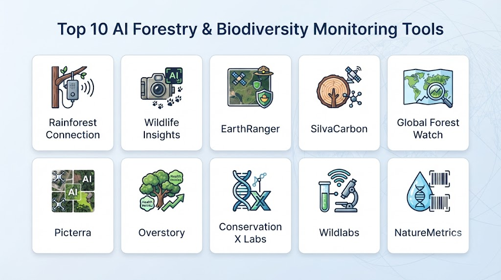
Top 10 AI Forestry & Biodiversity Monitoring Tools
1 — EarthRanger
One-line verdict: Best for conservation teams coordinating wildlife monitoring, field operations, spatial data, and protected-area management.
Short description:
EarthRanger is a conservation technology platform designed to help organizations collect, visualize, and analyze information about wildlife, protected areas, and field operations. It can bring together observations, tracking information, alerts, and operational data.
Standout Capabilities
- Wildlife monitoring
- Protected-area management
- Geospatial visualization
- Field observations
- Animal tracking
- Alerts
- Ranger operations
- Conservation data management
AI-Specific Depth
- Model support: AI capabilities vary by connected systems and workflows.
- RAG / knowledge integration: N/A.
- Evaluation: Depends on integrated monitoring and detection systems.
- Guardrails: Access and operational controls vary by deployment.
- Observability: Monitoring dashboards and operational visibility.
Pros
- Designed specifically for conservation workflows.
- Strong geospatial and field-operation capabilities.
- Can consolidate different sources of conservation information.
Cons
- More focused on conservation operations than standalone AI model development.
- Advanced AI functionality may depend on integrations.
- Implementation can require organizational configuration.
Security & Compliance
Security controls and access management depend on deployment and organizational requirements. Specific certifications should be verified before procurement.
Deployment & Platforms
- Deployment: Cloud/software platform.
- Web: Supported.
- Mobile/field: Field workflows are supported.
- Self-hosted: Varies / N/A.
- Hybrid: Varies.
Integrations & Ecosystem
EarthRanger is designed to work with multiple conservation data sources.
- GPS tracking
- Camera systems
- Sensors
- Field observations
- GIS data
- Alerts
- External conservation systems
Pricing Model
Pricing and availability vary by organization and deployment; exact commercial pricing is not publicly standardized.
Best-Fit Scenarios
- Protected-area monitoring
- Wildlife conservation operations
- Ranger and field coordination
2 — Wildlife Insights
One-line verdict: Best for organizations using camera traps to automate wildlife identification and biodiversity monitoring.
Short description:
Wildlife Insights uses AI to help researchers and conservation organizations process camera-trap images. Its computer-vision capabilities can identify animals and reduce the manual effort involved in reviewing large image collections.
Standout Capabilities
- Camera-trap image analysis
- Species identification
- Wildlife detection
- Biodiversity monitoring
- Image management
- Automated classification
- Ecological research
- Conservation data
AI-Specific Depth
- Model support: Specialized machine-learning models for wildlife imagery.
- RAG / knowledge integration: N/A.
- Evaluation: Species-recognition models are evaluated against labeled wildlife imagery.
- Guardrails: Human validation remains important for uncertain classifications.
- Observability: Image and monitoring workflows provide dataset-level visibility.
Pros
- Purpose-built for wildlife monitoring.
- Reduces manual camera-trap image review.
- Useful for large biodiversity datasets.
Cons
- Primarily focused on camera-trap imagery.
- Rare species can be more difficult to identify.
- Field hardware remains necessary.
Security & Compliance
Wildlife-location information can be sensitive. Organizations should review access controls, data-sharing practices, and retention policies for their specific deployment.
Deployment & Platforms
- Deployment: Cloud-based platform.
- Web: Supported.
- Field hardware: Camera traps.
- Self-hosted: N/A / varies.
- Mobile: Field workflows may vary.
Integrations & Ecosystem
- Camera traps
- Wildlife datasets
- Species observations
- Conservation projects
- Ecological research
- Image databases
Pricing Model
Availability and pricing depend on the program and organizational use case; exact commercial pricing is not publicly standardized.
Best-Fit Scenarios
- Camera-trap surveys
- Wildlife research
- Biodiversity monitoring
3 — Wildlife Acoustics
One-line verdict: Best for biodiversity projects using acoustic monitoring to identify wildlife through environmental sound recordings.
Short description:
Wildlife Acoustics provides hardware and software for bioacoustic monitoring. Its technologies can support automated analysis of environmental recordings, including applications involving birds, bats, and other wildlife.
Standout Capabilities
- Bioacoustic monitoring
- Wildlife sound recording
- Bird monitoring
- Bat monitoring
- Acoustic analysis
- Automated detection
- Field recording
- Long-duration monitoring
AI-Specific Depth
- Model support: Species-specific acoustic models vary by product and workflow.
- RAG / knowledge integration: N/A.
- Evaluation: Detection performance depends on species, recordings, and model configuration.
- Guardrails: N/A for conventional generative-AI safety.
- Observability: Recording and detection analytics vary.
Pros
- Strong specialization in bioacoustics.
- Supports long-duration environmental monitoring.
- Useful when visual monitoring is difficult.
Cons
- Acoustic monitoring does not directly observe physical characteristics.
- Background noise can affect detection.
- Species identification varies by available models and recordings.
Security & Compliance
Security and data-management features vary by product and deployment.
Deployment & Platforms
- Deployment: Field hardware plus software.
- Edge: Supported in relevant monitoring workflows.
- Cloud: Varies.
- Desktop: Supported through relevant software workflows.
- Mobile: Varies.
Integrations & Ecosystem
- Acoustic sensors
- Microphones
- Wildlife datasets
- Analysis software
- Species classifiers
- Field monitoring systems
Pricing Model
Hardware and software pricing varies by product and deployment.
Best-Fit Scenarios
- Bird monitoring
- Bat monitoring
- Long-term acoustic biodiversity surveys
4 — Arbimon
One-line verdict: Best for large-scale biodiversity monitoring using automated analysis of environmental acoustic recordings.
Short description:
Arbimon is an ecological monitoring platform focused on acoustic data. It helps researchers and conservation teams analyze large collections of environmental recordings and identify biological patterns.
Standout Capabilities
- Acoustic monitoring
- Species detection
- Biodiversity analysis
- Automated classification
- Environmental sound analysis
- Long-term monitoring
- Ecological research
- Large-scale datasets
AI-Specific Depth
- Model support: Machine-learning and acoustic classification capabilities.
- RAG / knowledge integration: N/A.
- Evaluation: Model performance can be evaluated against labeled recordings.
- Guardrails: Human validation is important for ecological conclusions.
- Observability: Acoustic datasets and detection outputs provide monitoring visibility.
Pros
- Strong ecological-acoustics focus.
- Useful for large recording datasets.
- Can reduce manual listening effort.
Cons
- Requires suitable acoustic recordings.
- Environmental noise can affect model performance.
- Acoustic monitoring requires careful survey design.
Security & Compliance
Specific security and compliance capabilities should be confirmed for the deployment.
Deployment & Platforms
- Deployment: Cloud/software platform.
- Web: Supported.
- Field: Acoustic recording hardware required.
- Self-hosted: Varies / N/A.
- Hybrid: Varies.
Integrations & Ecosystem
- Acoustic sensors
- Audio datasets
- Machine-learning models
- Ecological surveys
- Species libraries
- Research workflows
Pricing Model
Pricing varies by program and deployment; exact pricing is not publicly standardized.
Best-Fit Scenarios
- Acoustic biodiversity studies
- Tropical forest monitoring
- Long-term ecological surveys
5 — NatureMetrics
One-line verdict: Best for biodiversity assessment combining environmental DNA with technology-enabled ecological monitoring and analysis.
Short description:
NatureMetrics specializes in biodiversity monitoring using environmental DNA and related ecological data. Its approach can help organizations assess species presence across ecosystems without relying exclusively on conventional visual surveys.
Standout Capabilities
- Environmental DNA monitoring
- Biodiversity assessment
- Species detection
- Ecological analysis
- Freshwater monitoring
- Terrestrial biodiversity
- Conservation assessment
- Environmental data
AI-Specific Depth
- Model support: Analytical and classification methods vary by service.
- RAG / knowledge integration: N/A.
- Evaluation: Laboratory and ecological validation processes vary.
- Guardrails: Data-quality and scientific validation processes.
- Observability: Results and biodiversity datasets provide analytical visibility.
Pros
- Can detect species that are difficult to observe visually.
- Useful for biodiversity assessment.
- Supports large-scale ecological monitoring programs.
Cons
- Requires sample collection.
- Does not replace every type of field survey.
- Results depend on sampling design and environmental conditions.
Security & Compliance
Data and laboratory controls vary by service. Specific certifications should be verified for the relevant project.
Deployment & Platforms
- Deployment: Field sampling plus laboratory/software workflows.
- Cloud: Varies.
- Self-hosted: N/A.
- Mobile: Varies.
Integrations & Ecosystem
- Environmental DNA
- Biodiversity databases
- Ecological surveys
- Laboratory analysis
- GIS workflows
- Conservation programs
Pricing Model
Service/project-based pricing; exact pricing varies.
Best-Fit Scenarios
- Biodiversity assessments
- Freshwater ecosystems
- Environmental monitoring programs
6 — Rainforest Connection
One-line verdict: Best for real-time rainforest monitoring using acoustic sensors and AI-assisted detection of environmental threats.
Short description:
Rainforest Connection develops technology for monitoring forests through acoustic sensors and AI-assisted analysis. Its approach can help conservation organizations detect events and changes in remote forest environments.
Standout Capabilities
- Forest monitoring
- Acoustic sensing
- AI-assisted detection
- Remote monitoring
- Deforestation detection
- Environmental alerts
- Biodiversity observation
- Conservation technology
AI-Specific Depth
- Model support: Proprietary and specialized machine-learning capabilities vary.
- RAG / knowledge integration: N/A.
- Evaluation: Detection performance depends on environmental conditions and target events.
- Guardrails: Alert validation and operational procedures are important.
- Observability: Monitoring and alerting provide operational visibility.
Pros
- Designed for difficult-to-access forest environments.
- Supports continuous monitoring.
- Acoustic monitoring can detect events that cameras may miss.
Cons
- Requires appropriate sensor deployment.
- Environmental noise can affect detection.
- Connectivity can be challenging in remote areas.
Security & Compliance
Security and access controls depend on deployment. Sensitive conservation data should be appropriately protected.
Deployment & Platforms
- Deployment: Field sensors plus software.
- Edge: Important for remote environments.
- Cloud: Used where connectivity permits.
- Hybrid: Relevant to remote deployments.
- Mobile: Varies.
Integrations & Ecosystem
- Acoustic sensors
- Forest monitoring
- Alerts
- Conservation teams
- Geospatial information
- Environmental datasets
Pricing Model
Project and deployment-based; exact pricing is not publicly standardized.
Best-Fit Scenarios
- Rainforest protection
- Remote forest monitoring
- Illegal-activity detection
7 — Planet
One-line verdict: Best for organizations requiring high-frequency satellite imagery and geospatial intelligence for forest and environmental monitoring.
Short description:
Planet provides satellite imagery and geospatial data that can be used to monitor land, forests, agriculture, and environmental change. AI and machine-learning workflows can be built on top of imagery to detect and analyze changes.
Standout Capabilities
- Satellite imagery
- Frequent Earth observation
- Forest monitoring
- Land-cover analysis
- Change detection
- Geospatial analytics
- Environmental intelligence
- API-based imagery access
AI-Specific Depth
- Model support: Supports geospatial AI workflows; specific model capabilities vary.
- RAG / knowledge integration: N/A.
- Evaluation: Depends on the model and imagery workflow.
- Guardrails: Data governance and access controls vary.
- Observability: Geospatial monitoring and imagery analytics.
Pros
- Strong satellite-data ecosystem.
- Useful for large geographic areas.
- Suitable for automated geospatial workflows.
Cons
- Satellite imagery does not replace all field observations.
- Cloud cover and resolution can affect analysis.
- Advanced AI workflows may require additional technical development.
Security & Compliance
Enterprise security, access controls, and data-management capabilities vary by product and contract.
Deployment & Platforms
- Deployment: Cloud/API.
- Web: Supported.
- API: Supported.
- Self-hosted: Data can be incorporated into customer workflows.
- Mobile: N/A.
Integrations & Ecosystem
- GIS
- APIs
- Satellite imagery
- Geospatial analytics
- Machine-learning workflows
- Earth-observation platforms
Pricing Model
Commercial subscription/data-access model; pricing varies by imagery, coverage, and usage.
Best-Fit Scenarios
- Forest-cover monitoring
- Large-area environmental assessment
- Satellite-based change detection
8 — Sentinel Hub
One-line verdict: Best for developers and environmental teams building custom AI workflows around satellite imagery and geospatial data.
Short description:
Sentinel Hub provides access to Earth-observation data and APIs that developers can use to build applications for environmental monitoring. It is particularly useful when organizations want to develop their own geospatial analytics and AI models.
Standout Capabilities
- Satellite-data access
- Geospatial APIs
- Image processing
- Earth observation
- Custom AI workflows
- Vegetation monitoring
- Change detection
- Developer integration
AI-Specific Depth
- Model support: Supports custom AI/ML workflows rather than being limited to one model.
- RAG / knowledge integration: N/A.
- Evaluation: User-defined model evaluation.
- Guardrails: Application-level security and governance.
- Observability: API and application monitoring depends on implementation.
Pros
- Strong developer flexibility.
- Suitable for custom environmental applications.
- Supports scalable satellite-data workflows.
Cons
- Requires technical expertise.
- AI models generally need to be developed or integrated separately.
- Costs depend on usage and data requirements.
Security & Compliance
Security controls vary by product and implementation.
Deployment & Platforms
- Deployment: Cloud/API.
- Web: Supported.
- API: Strong.
- Self-hosted: Custom processing can be implemented downstream.
- Mobile: Possible through custom applications.
Integrations & Ecosystem
- GIS platforms
- APIs
- Python workflows
- Satellite imagery
- Machine-learning frameworks
- Cloud infrastructure
Pricing Model
Usage/subscription-based; exact pricing varies by service and usage.
Best-Fit Scenarios
- Custom biodiversity applications
- Satellite-based forest monitoring
- Developer-led environmental analytics
9 — Wildlife Insights-compatible Camera Trap AI Workflows
One-line verdict: Best for research teams needing scalable AI-assisted processing of large wildlife camera-trap datasets.
Short description:
Modern camera-trap workflows can combine specialized wildlife-recognition models with cloud storage, ecological databases, and human validation. These systems are especially valuable when thousands or millions of images need to be processed.
Standout Capabilities
- Automated image classification
- Species recognition
- Camera-trap processing
- Dataset management
- Human validation
- Biodiversity analysis
- Large-scale image processing
- Research workflows
AI-Specific Depth
- Model support: Wildlife-specific computer-vision models vary.
- RAG / knowledge integration: N/A.
- Evaluation: Labeled datasets and human validation.
- Guardrails: Confidence thresholds and human review can reduce incorrect classifications.
- Observability: Dataset-level detection statistics.
Pros
- Scales wildlife-image processing.
- Reduces manual classification.
- Can support research-grade datasets.
Cons
- Model accuracy varies significantly by species.
- Rare species remain challenging.
- Requires careful ecological validation.
Security & Compliance
Wildlife observations may contain sensitive location information and should be protected appropriately.
Deployment & Platforms
- Deployment: Cloud and field-camera workflows.
- Edge: Possible depending on the camera system.
- Cloud: Common.
- Self-hosted: Varies.
- Mobile: Varies.
Integrations & Ecosystem
- Camera traps
- Wildlife databases
- GIS
- Ecological research
- Species classifiers
- Conservation platforms
Pricing Model
Varies by platform, model, hardware, and deployment.
Best-Fit Scenarios
- Large camera-trap projects
- Wildlife surveys
- Biodiversity research
10 — Microsoft Planetary Computer
One-line verdict: Best for technical teams building large-scale environmental AI and geospatial analysis using public Earth-observation datasets.
Short description:
Microsoft Planetary Computer provides data, APIs, and computing resources designed to support environmental science and geospatial analysis. Technical teams can use it as an infrastructure layer for custom forest and biodiversity applications.
Standout Capabilities
- Earth-observation data
- Geospatial analysis
- Environmental datasets
- Cloud computing
- Machine-learning workflows
- Biodiversity research
- Forest monitoring
- Developer APIs
AI-Specific Depth
- Model support: Flexible for custom machine-learning models.
- RAG / knowledge integration: N/A.
- Evaluation: User-defined.
- Guardrails: Cloud-level and application-level controls.
- Observability: Depends on the implemented architecture.
Pros
- Strong developer flexibility.
- Useful for large geospatial datasets.
- Supports custom environmental AI projects.
Cons
- Requires technical expertise.
- Not a turnkey wildlife-monitoring system.
- Customers may need to build their own models and workflows.
Security & Compliance
Security capabilities depend on the underlying cloud environment and project configuration. Specific requirements should be evaluated for the deployment.
Deployment & Platforms
- Deployment: Cloud.
- Web: Supported.
- API: Supported.
- Self-hosted: Custom downstream processing possible.
- Mobile: Through custom applications.
Integrations & Ecosystem
- Cloud computing
- GIS
- Satellite datasets
- Python
- Machine learning
- APIs
- Data science workflows
Pricing Model
Cloud and usage-based costs can vary by computing, storage, and data requirements.
Best-Fit Scenarios
- Environmental AI development
- Large-scale forest analysis
- Research and geospatial modeling
Comparison Table
| Tool | Best For | Deployment | Model Flexibility | Strength | Watch-Out | Public Rating |
|---|---|---|---|---|---|---|
| EarthRanger | Conservation operations | Cloud/Hybrid | Integrated AI + external models | Field intelligence | Configuration required | N/A |
| Wildlife Insights | Camera-trap monitoring | Cloud | Specialized AI | Species recognition | Rare-species accuracy | N/A |
| Wildlife Acoustics | Acoustic monitoring | Field/Cloud | Specialized models | Bioacoustics | Environmental noise | N/A |
| Arbimon | Acoustic biodiversity | Cloud | ML workflows | Audio analysis | Requires recordings | N/A |
| NatureMetrics | Biodiversity assessment | Field/Lab/Cloud | Analytical models | eDNA monitoring | Sampling required | N/A |
| Rainforest Connection | Forest protection | Field/Cloud | Specialized AI | Acoustic alerts | Remote connectivity | N/A |
| Planet | Satellite monitoring | Cloud/API | Flexible | Earth observation | Requires analysis | N/A |
| Sentinel Hub | Custom geospatial AI | Cloud/API | Multi-model/custom | Developer flexibility | Technical expertise | N/A |
| Camera Trap AI Workflows | Wildlife research | Cloud/Hybrid | Specialized AI | Image processing | Dataset quality | N/A |
| Microsoft Planetary Computer | Environmental AI | Cloud | Custom/open workflows | Geospatial computing | Developer-heavy | N/A |
Scoring & Evaluation
The scoring below is comparative rather than an official vendor score. It emphasizes how useful each platform can be for AI-driven forestry and biodiversity monitoring.
| Tool | Core | Reliability/Eval | Guardrails | Integrations | Ease | Perf/Cost | Security/Admin | Support | Weighted Total |
|---|---|---|---|---|---|---|---|---|---|
| EarthRanger | 10 | 8 | 8 | 10 | 8 | 8 | 8 | 9 | 8.65 |
| Wildlife Insights | 9 | 9 | 8 | 9 | 9 | 9 | 8 | 8 | 8.75 |
| Wildlife Acoustics | 9 | 9 | 8 | 8 | 8 | 8 | 8 | 9 | 8.45 |
| Arbimon | 9 | 9 | 8 | 9 | 8 | 9 | 8 | 8 | 8.60 |
| NatureMetrics | 9 | 9 | 8 | 8 | 8 | 8 | 9 | 9 | 8.55 |
| Rainforest Connection | 9 | 9 | 9 | 8 | 8 | 8 | 8 | 9 | 8.55 |
| Planet | 10 | 9 | 8 | 10 | 8 | 8 | 9 | 9 | 8.90 |
| Sentinel Hub | 9 | 9 | 8 | 10 | 7 | 9 | 8 | 8 | 8.65 |
| Camera Trap AI Workflows | 9 | 9 | 8 | 9 | 8 | 9 | 8 | 8 | 8.60 |
| Microsoft Planetary Computer | 10 | 9 | 8 | 10 | 7 | 9 | 9 | 9 | 8.95 |
Top 3 for Enterprise
- Microsoft Planetary Computer
- Planet
- EarthRanger
Top 3 for SMB
- Wildlife Insights
- Arbimon
- Wildlife Acoustics
Top 3 for Developers
- Microsoft Planetary Computer
- Sentinel Hub
- Planet
Which AI Forestry & Biodiversity Monitoring Tool Is Right for You?
Solo / Freelancer
For individuals, a complete conservation platform may be unnecessary.
A practical starting architecture is:
Camera/Satellite Data → Open Dataset → Computer Vision Model → Classification → GIS Visualization
Use a lightweight workflow when the goal is research, experimentation, or a small proof of concept.
SMB
Small environmental consultancies and conservation organizations should favor platforms that reduce infrastructure requirements.
Prioritize:
- Ready-made species models
- Simple dashboards
- Camera-trap processing
- Acoustic analysis
- GIS compatibility
- Exportable datasets
- Reasonable field requirements
Mid-Market
Mid-market organizations often need a combination of automation and scientific validation.
Consider combining:
- Satellite imagery
- Camera traps
- Acoustic sensors
- GIS
- Field observations
- AI classification
This creates a more complete picture of ecosystem conditions.
Enterprise
Large conservation organizations, governments, forestry companies, and environmental enterprises should consider a multi-source architecture.
For example:
Satellite → Drone → Camera Trap → Acoustic Sensor → AI Models → GIS → Risk/Change Detection → Human Validation → Conservation Action
Enterprise buyers should also evaluate data residency, sensitive species-location protection, API access, integration capabilities, and long-term model governance.
Regulated Industries
Government and environmentally sensitive organizations should pay particular attention to:
- Data ownership
- Wildlife-location privacy
- Access controls
- Auditability
- Data retention
- Model transparency
- Human review
- Scientific reproducibility
- Incident management
Budget vs Premium
Budget projects can start with:
- Existing satellite datasets
- Low-cost camera traps
- Open-source models
- Cloud-based analysis
- Manual validation
Premium deployments become valuable when organizations need continuous monitoring, large geographic coverage, dedicated sensors, real-time alerts, or operational integration.
Build vs Buy
Buy when you need a ready-to-use conservation workflow and field support.
Build when you need specialized models, proprietary ecological datasets, custom satellite analytics, or integration with existing research infrastructure.
A hybrid approach is often the most practical: use established platforms for data collection and management while building custom models for specialized species or habitats.
Implementation Playbook
30 Days: Pilot + Success Metrics
- Define monitoring objectives.
- Select target species or environmental indicators.
- Identify available satellite, camera, or acoustic data.
- Establish a baseline dataset.
- Define accuracy targets.
- Select representative monitoring locations.
- Create a labeled validation dataset.
- Establish confidence thresholds.
- Identify sensitive wildlife-location information.
- Define field-validation procedures.
Measure:
- Detection accuracy
- False-positive rate
- False-negative rate
- Species coverage
- Processing time
- Data completeness
- Alert accuracy
- Cost per observation
60 Days: Harden Security + Evaluation + Rollout
- Create an evaluation dataset.
- Test rare and difficult species.
- Validate seasonal changes.
- Test different lighting and weather conditions.
- Evaluate satellite-image quality.
- Test acoustic noise conditions.
- Establish model-version control.
- Implement human validation.
- Protect sensitive location data.
- Establish access-control policies.
- Test API integrations.
90 Days: Optimize Cost + Latency + Governance
- Optimize model inference.
- Reduce unnecessary cloud processing.
- Deploy edge AI where connectivity is limited.
- Automate recurring monitoring.
- Track model drift.
- Compare AI predictions with field surveys.
- Create ecological incident workflows.
- Establish governance procedures.
- Expand monitoring coverage.
- Create long-term biodiversity reporting.
Common Mistakes & How to Avoid Them
- Treating AI predictions as ground truth: Validate important observations through appropriate field methods.
- Ignoring rare species: Common species usually have more training examples than rare species.
- Using biased datasets: Training data should represent different habitats, seasons, locations, and environmental conditions.
- Ignoring seasonal variation: Wildlife behavior and vegetation can change substantially throughout the year.
- Overlooking sensor limitations: Cameras and acoustic sensors have different detection ranges and failure modes.
- Ignoring cloud cover: Satellite-based analysis can be affected by image availability and atmospheric conditions.
- No uncertainty reporting: Important conservation decisions should consider model confidence.
- No human review: Ambiguous or high-impact observations should receive expert validation.
- Exposing sensitive species locations: Data about endangered species should be protected carefully.
- Ignoring model drift: Species behavior, habitats, and environmental conditions change.
- Using one data source: Combining satellite, acoustic, visual, and field information can improve situational understanding.
- No evaluation dataset: Establish independent validation data before measuring deployment performance.
- Ignoring connectivity: Remote forests may require edge processing or offline workflows.
- Underestimating storage: Camera traps and acoustic sensors can generate very large datasets.
- Ignoring field maintenance: Batteries, sensors, cameras, and communication systems require regular maintenance.
FAQs
What is AI forestry monitoring?
AI forestry monitoring uses machine learning, computer vision, satellite imagery, drones, sensors, and related technologies to detect and analyze forest conditions.
What is AI biodiversity monitoring?
It uses AI to identify species, analyze habitats, process ecological recordings, and detect changes in biodiversity across large datasets.
Can AI identify wildlife from camera traps?
Yes. Specialized computer-vision models can classify many wildlife images, although performance varies by species, image quality, habitat, and training data.
Can AI monitor forests using satellites?
Yes. Satellite imagery can be analyzed to identify vegetation changes, forest loss, land-cover changes, fires, and other environmental patterns.
Can AI detect illegal logging?
AI can help identify patterns associated with forest disturbance or suspicious activity, particularly when combined with satellite, acoustic, or field data. Human verification may still be necessary.
Can AI monitor biodiversity through sound?
Yes. Bioacoustic systems can analyze environmental recordings to detect birds, bats, insects, mammals, and other biological signals.
Does AI replace biodiversity field surveys?
No. AI can reduce repetitive data-processing work and expand monitoring coverage, but field surveys remain important for validation and ecological interpretation.
What data does biodiversity AI require?
Depending on the application, it can use photographs, acoustic recordings, satellite imagery, drone imagery, environmental DNA, GPS observations, weather information, and field observations.
Can these platforms work offline?
Some field-monitoring systems can support edge or offline workflows, but capabilities vary substantially between products.
How accurate is AI species identification?
There is no universal accuracy level. Performance depends on species, habitat, sensor quality, training data, environmental conditions, and model configuration.
Can organizations use their own models?
Some platforms support custom or integrated machine-learning workflows, while others focus primarily on their own models and services.
Is satellite imagery enough for biodiversity monitoring?
Usually not. Satellite imagery provides valuable habitat and landscape information but may need to be combined with field, acoustic, camera-trap, or other biological observations.
How can AI help forestry companies?
AI can support forest inventory, vegetation monitoring, change detection, habitat assessment, disturbance detection, restoration monitoring, and large-area environmental analysis.
How should sensitive wildlife data be protected?
Organizations should apply access controls, appropriate retention policies, secure storage, and careful sharing practices, especially for locations of endangered species.
What is multimodal biodiversity monitoring?
It combines multiple data types, such as satellite imagery, photographs, audio, sensor measurements, and field observations, to create a more complete ecological picture.
What is the biggest challenge with AI biodiversity monitoring?
Data quality and ecological validation remain major challenges. An impressive model can still produce misleading results if the training data or survey design is poor.
How much does AI forestry monitoring cost?
Costs vary significantly depending on satellite imagery, sensors, drones, cameras, cloud processing, software, field teams, and geographic coverage.
Should organizations build or buy biodiversity AI?
Organizations should generally buy when they need a mature monitoring workflow and build when they require specialized models or unique research capabilities.
Conclusion
AI Forestry & Biodiversity Monitoring is transforming how forests, wildlife, and ecosystems can be observed at scale. Computer vision can process thousands of camera-trap images, acoustic AI can analyze long environmental recordings, and geospatial AI can turn satellite imagery into actionable information about forests and habitats.The most effective strategy is rarely to depend on one technology. Combining satellite imagery, camera traps, acoustic monitoring, field observations, GIS, and AI can provide a more complete and reliable understanding of environmental change.Tools such as EarthRanger, Wildlife Insights, Arbimon, Wildlife Acoustics, Planet, Sentinel Hub, and Microsoft Planetary Computer serve different parts of this ecosystem. The best choice depends on whether your priority is wildlife identification, forest change detection, acoustic monitoring, conservation operations, or custom geospatial AI.