Introduction
Robotics SLAM (Simultaneous Localization and Mapping) Toolkits with AI help robots understand where they are while simultaneously building a map of their environment. SLAM combines sensor data from cameras, LiDAR, depth sensors, IMUs, and other sources to estimate robot movement and create maps that can later support navigation, obstacle avoidance, inspection, and autonomous decision-making.
Modern SLAM systems increasingly combine classical geometry with machine learning. AI can improve visual feature extraction, loop-closure recognition, semantic understanding, place recognition, depth estimation, and robustness in difficult environments. The result is a perception stack that can move beyond purely geometric maps toward richer representations of the world.
Best for: Robotics engineers, autonomous-system developers, research teams, warehouse automation companies, drone developers, industrial robotics organizations, universities, and businesses building robots that need reliable localization and mapping.
Not ideal for: Simple fixed industrial automation, robots operating in fully known environments, or applications where localization can be solved with simpler methods such as fixed markers, GPS, wheel odometry, or predefined maps.
What’s Changed in Robotics SLAM (Mapping) Toolkits with AI
- AI-assisted feature extraction is improving visual SLAM: Learned features can help robots identify useful visual information in challenging environments.
- Semantic SLAM is becoming more practical: Instead of mapping only geometry, systems can associate areas of a map with objects, rooms, surfaces, and other semantic information.
- Multisensor SLAM is increasingly common: Cameras, LiDAR, IMUs, wheel encoders, GNSS, and depth sensors can be combined to improve robustness.
- 3D mapping is becoming more detailed: Modern systems can create dense point clouds, meshes, voxel maps, and other spatial representations.
- Neural representations are emerging: Neural rendering and learned scene representations are creating new approaches to mapping and localization.
- Foundation models may improve place understanding: Vision-language models can potentially provide higher-level scene understanding on top of traditional localization.
- Edge inference matters: Robots often need localization and mapping with limited power and compute.
- Simulation is increasingly important: SLAM systems can be tested across large numbers of environments before physical deployment.
- AI evaluation is expanding: Developers increasingly evaluate not only trajectory accuracy but also failure recovery, loop closure, robustness, latency, and resource consumption.
- Dynamic environments are receiving more attention: Modern systems need to distinguish permanent environmental structure from moving people, vehicles, and objects.
- Real-time performance remains critical: A highly accurate mapping system is not useful if it cannot maintain the required update rate.
- Long-term autonomy is becoming a key requirement: Robots operating for months or years need systems capable of handling environmental changes and map updates.
- Security and privacy are increasingly important: SLAM systems may collect detailed visual and spatial information about private or sensitive environments.
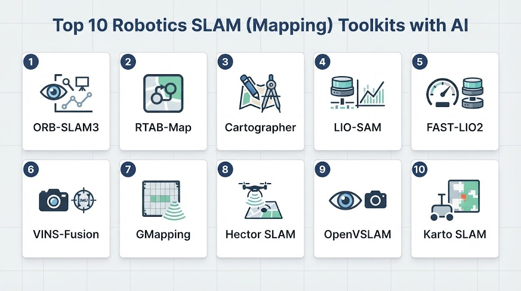
Top 10 Robotics SLAM (Mapping) Toolkits with AI
1 — ORB-SLAM3
One-line verdict: Best for researchers and developers building accurate visual and visual-inertial SLAM systems across varied robotic platforms.
Short description:
ORB-SLAM3 is a widely recognized visual SLAM system supporting monocular, stereo, RGB-D, and visual-inertial configurations. It is useful for robotics, autonomous systems, and research applications requiring camera-based localization and mapping.
Standout Capabilities
- Monocular SLAM
- Stereo SLAM
- RGB-D SLAM
- Visual-inertial SLAM
- Loop-closure detection
- Relocalization
- Multiple map support
- Strong research ecosystem
AI-Specific Depth
- Model support: Primarily geometry and feature-based; can be extended with learned components
- RAG / knowledge integration: N/A
- Evaluation: Extensive academic benchmarking and developer testing
- Guardrails: Application-specific
- Observability: Trajectory and mapping outputs; additional monitoring is developer-managed
Pros
- Mature and widely studied
- Supports several camera configurations
- Excellent for research and experimentation
Cons
- Integration requires robotics expertise
- Not a complete autonomous-navigation platform
- Learned perception requires additional components
Security & Compliance
Security depends on the application and deployment architecture. Specific certifications are not inherent to the toolkit.
Deployment & Platforms
- Deployment: Edge and workstation environments
- Linux: Strong support
- Windows: Possible with appropriate setup
- macOS: Possible with appropriate setup
- Mobile: Varies / N/A
Integrations & Ecosystem
ORB-SLAM3 can be integrated into broader robotics stacks.
- ROS/ROS 2 integrations
- Cameras
- IMUs
- OpenCV
- Robotics research platforms
- Custom navigation systems
Pricing Model
Open-source software; commercial use should be reviewed against the applicable license.
Best-Fit Scenarios
- Visual robotics research
- Camera-based localization
- Visual-inertial robotics
2 — RTAB-Map
One-line verdict: Best for practical RGB-D and LiDAR mapping with strong ROS integration and support for large-scale robotic environments.
Short description:
RTAB-Map is a graph-based SLAM approach designed for real-time appearance-based mapping and localization. It supports RGB-D cameras, stereo cameras, LiDAR, and other sensor configurations, making it useful for mobile robotics and 3D mapping.
Standout Capabilities
- RGB-D SLAM
- Stereo SLAM
- LiDAR integration
- Loop closure
- 3D mapping
- Graph-based optimization
- Large-environment mapping
- ROS integration
AI-Specific Depth
- Model support: Primarily geometric and appearance-based; external AI models can be integrated
- RAG / knowledge integration: N/A
- Evaluation: Mapping and trajectory evaluation through standard robotics workflows
- Guardrails: Application-specific
- Observability: Mapping graphs, trajectories, and visualization
Pros
- Broad sensor support
- Strong robotics ecosystem
- Useful for practical mapping applications
Cons
- Configuration can become complex
- Advanced deployments require tuning
- AI functionality is not its primary focus
Security & Compliance
Security depends on deployment architecture.
Deployment & Platforms
- Deployment: Edge, workstation, and robot computers
- Linux: Strong support
- Windows: Supported
- macOS: Varies
- Cloud: Can be integrated into cloud workflows
Integrations & Ecosystem
- ROS 2
- RGB-D cameras
- Stereo cameras
- LiDAR
- IMUs
- OpenCV
- Navigation stacks
Pricing Model
Open-source.
Best-Fit Scenarios
- Mobile robots
- 3D mapping
- RGB-D robotics
3 — Google Cartographer
One-line verdict: Best for developers needing established 2D and 3D SLAM concepts with strong sensor-fusion capabilities.
Short description:
Cartographer is a robotics SLAM system designed to provide real-time simultaneous localization and mapping using sensor data such as LiDAR and IMU measurements. It has been used extensively in robotics research and development.
Standout Capabilities
- 2D SLAM
- 3D SLAM
- LiDAR processing
- IMU integration
- Pose estimation
- Local and global trajectory optimization
- Sensor fusion
- Map generation
AI-Specific Depth
- Model support: Primarily algorithmic rather than neural; external AI can complement it
- RAG / knowledge integration: N/A
- Evaluation: Standard SLAM trajectory and mapping evaluation
- Guardrails: N/A
- Observability: Pose graphs, trajectories, and map outputs
Pros
- Strong SLAM architecture
- Good sensor-fusion concepts
- Suitable for research and robotics systems
Cons
- Development activity should be considered before selecting it for new projects
- Integration can require expertise
- AI capabilities require external models
Security & Compliance
Application-specific.
Deployment & Platforms
- Deployment: Robot and edge environments
- Linux: Primary
- Windows: Varies / N/A
- macOS: Varies / N/A
Integrations & Ecosystem
- ROS
- LiDAR
- IMU
- Odometry
- Robotics hardware
- Mapping tools
Pricing Model
Open-source.
Best-Fit Scenarios
- SLAM research
- LiDAR mapping
- Sensor-fusion experiments
4 — OpenVSLAM
One-line verdict: Best for flexible visual SLAM experimentation across monocular, stereo, and RGB-D camera configurations.
Short description:
OpenVSLAM is a feature-based visual SLAM framework designed for flexible camera-based localization and mapping. It can be useful for developers researching visual navigation and mapping.
Standout Capabilities
- Monocular SLAM
- Stereo SLAM
- RGB-D SLAM
- Loop detection
- Relocalization
- Camera model support
- Map management
- Visual localization
AI-Specific Depth
- Model support: Primarily traditional visual SLAM; external learned features can complement the system
- RAG / knowledge integration: N/A
- Evaluation: Developer-controlled SLAM benchmarking
- Guardrails: N/A
- Observability: Pose and map outputs
Pros
- Flexible visual architecture
- Useful for experimentation
- Supports multiple camera configurations
Cons
- Project maintenance should be evaluated carefully
- Not a complete robotics platform
- Additional components are required for modern AI perception
Security & Compliance
Application-specific.
Deployment & Platforms
- Deployment: Edge/workstation
- Linux: Supported
- Windows: Varies
- macOS: Varies
Integrations & Ecosystem
- OpenCV
- Cameras
- ROS
- Custom AI models
- Robotics platforms
Pricing Model
Open-source.
Best-Fit Scenarios
- Visual SLAM research
- Camera-based robotics
- Experimental systems
5 — Open3D
One-line verdict: Best for modern 3D mapping, point-cloud processing, reconstruction, and AI-assisted spatial perception workflows.
Short description:
Open3D provides a modern toolkit for processing, visualizing, and reconstructing 3D data. Although it is not solely a SLAM framework, its capabilities make it useful for robotics mapping pipelines involving RGB-D data, point clouds, registration, and 3D reconstruction.
Standout Capabilities
- 3D point-cloud processing
- RGB-D processing
- Registration
- 3D reconstruction
- Mapping
- Visualization
- Tensor-based operations
- Machine-learning integration
AI-Specific Depth
- Model support: Supports integration with AI and machine-learning workflows
- RAG / knowledge integration: N/A
- Evaluation: Developer-controlled benchmarking
- Guardrails: N/A
- Observability: Visualization and application-level metrics
Pros
- Modern 3D development environment
- Strong Python support
- Excellent for 3D research
Cons
- Not a complete navigation framework
- Requires additional SLAM/navigation components
- Production integration requires engineering
Security & Compliance
Security depends on deployment architecture.
Deployment & Platforms
- Deployment: Edge, workstation, and server
- Linux: Supported
- Windows: Supported
- macOS: Supported
Integrations & Ecosystem
- Python
- C++
- ROS 2
- RGB-D sensors
- LiDAR
- AI frameworks
- 3D datasets
Pricing Model
Open-source.
Best-Fit Scenarios
- 3D mapping
- Robotics research
- Spatial AI
6 — NVIDIA Isaac ROS Visual SLAM
One-line verdict: Best for GPU-accelerated visual SLAM on NVIDIA-powered robots requiring real-time localization and mapping.
Short description:
NVIDIA Isaac ROS provides GPU-accelerated robotics components, including visual SLAM capabilities designed to work within ROS 2-based robotic systems. It is particularly attractive for robots already using NVIDIA Jetson or GPU computing platforms.
Standout Capabilities
- Visual SLAM
- Visual-inertial processing
- GPU acceleration
- ROS 2 integration
- Real-time robotics workloads
- Camera integration
- Embedded deployment
- NVIDIA hardware optimization
AI-Specific Depth
- Model support: NVIDIA-optimized perception components and external AI models
- RAG / knowledge integration: N/A
- Evaluation: Robotics benchmarking and developer testing
- Guardrails: Application-specific
- Observability: ROS 2 diagnostics and performance profiling
Pros
- Strong embedded performance
- Excellent ROS 2 integration
- Well suited to NVIDIA robotics hardware
Cons
- NVIDIA hardware dependency
- Requires familiarity with GPU computing
- Can increase ecosystem lock-in
Security & Compliance
Security depends on ROS 2 configuration, operating system, hardware, and application architecture.
Deployment & Platforms
- Deployment: Edge robotics
- Linux: Primary
- NVIDIA Jetson: Strong fit
- Cloud: Can support development and broader architectures
Integrations & Ecosystem
- ROS 2
- NVIDIA Jetson
- NVIDIA GPUs
- Cameras
- IMUs
- Navigation stacks
- Isaac Sim
Pricing Model
Software and hardware costs vary according to the NVIDIA platform and deployment.
Best-Fit Scenarios
- Autonomous mobile robots
- AI-powered visual SLAM
- NVIDIA-based robot fleets
7 — Kimera
One-line verdict: Best for research teams exploring robust visual-inertial SLAM, 3D reconstruction, and semantic spatial understanding.
Short description:
Kimera is a modular open-source library for real-time metric-semantic SLAM. It combines visual-inertial estimation with 3D reconstruction and semantic understanding, making it relevant to advanced robotics research.
Standout Capabilities
- Visual-inertial odometry
- Metric-semantic mapping
- 3D reconstruction
- Mesh generation
- Loop closure
- Semantic understanding
- Modular architecture
- Research-oriented design
AI-Specific Depth
- Model support: Can integrate learned perception models
- RAG / knowledge integration: N/A
- Evaluation: Research-grade SLAM evaluation
- Guardrails: N/A
- Observability: Trajectories, maps, and reconstruction outputs
Pros
- Advanced research capabilities
- Strong semantic-mapping direction
- Modular architecture
Cons
- Better suited to experienced developers
- Integration complexity
- Production support varies by component
Security & Compliance
Application-specific.
Deployment & Platforms
- Deployment: Edge/workstation
- Linux: Primary
- Other platforms: Varies / N/A
Integrations & Ecosystem
- ROS
- Cameras
- IMUs
- OpenCV
- 3D reconstruction tools
- Machine-learning models
Pricing Model
Open-source.
Best-Fit Scenarios
- Academic robotics
- Semantic SLAM
- Advanced 3D reconstruction
8 — VINS-Fusion
One-line verdict: Best for visual-inertial sensor fusion when accurate state estimation is more important than dense semantic mapping.
Short description:
VINS-Fusion is a multi-sensor state-estimation framework focused on visual-inertial navigation. It can combine camera and IMU information with additional sensor inputs for robust pose estimation.
Standout Capabilities
- Visual-inertial odometry
- Sensor fusion
- Loop closure
- Pose estimation
- Stereo camera support
- GPS integration
- Real-time estimation
- Multi-sensor workflows
AI-Specific Depth
- Model support: Primarily geometric; learned models can be integrated externally
- RAG / knowledge integration: N/A
- Evaluation: Trajectory-estimation benchmarking
- Guardrails: N/A
- Observability: Pose estimates and trajectory outputs
Pros
- Strong state-estimation capabilities
- Useful sensor fusion
- Suitable for drones and mobile robots
Cons
- Not a complete mapping platform
- AI capabilities require external components
- Advanced tuning may be necessary
Security & Compliance
Application-specific.
Deployment & Platforms
- Deployment: Edge robotics
- Linux: Primary
- Other platforms: Varies / N/A
Integrations & Ecosystem
- Cameras
- IMUs
- GPS
- ROS
- Robotics platforms
- Navigation systems
Pricing Model
Open-source.
Best-Fit Scenarios
- Drones
- Visual-inertial robotics
- Sensor-fusion research
9 — RTAB-Map ROS 2
One-line verdict: Best practical ROS 2-oriented choice for integrating visual, depth, and LiDAR mapping into mobile robots.
Short description:
RTAB-Map’s ROS 2 ecosystem provides a practical route for integrating mapping and localization with robotic sensors and navigation systems. It is particularly useful when developers want a ready-made SLAM component within a larger ROS 2 architecture.
Standout Capabilities
- ROS 2 integration
- RGB-D SLAM
- LiDAR support
- Loop closure
- 3D maps
- Localization
- Navigation integration
- Visualization
AI-Specific Depth
- Model support: External AI models can be integrated with the perception pipeline
- RAG / knowledge integration: N/A
- Evaluation: Standard robotics mapping evaluation
- Guardrails: Application-specific
- Observability: ROS 2 logs, maps, trajectories, and diagnostics
Pros
- Practical integration
- Strong sensor compatibility
- Useful for mobile robots
Cons
- Configuration can be complex
- AI functionality is not its core purpose
- Performance depends on sensor and compute configuration
Security & Compliance
Depends on the underlying ROS 2 and deployment architecture.
Deployment & Platforms
- Deployment: Edge/robot
- Linux: Strong support
- ROS 2: Supported
Integrations & Ecosystem
- ROS 2
- LiDAR
- RGB-D cameras
- Stereo cameras
- Navigation systems
- IMUs
- Visualization tools
Pricing Model
Open-source.
Best-Fit Scenarios
- ROS 2 mobile robots
- Indoor mapping
- Multi-sensor SLAM
10 — Nerfstudio
One-line verdict: Best for developers exploring neural scene representations, 3D reconstruction, and AI-driven spatial mapping research.
Short description:
Nerfstudio is a framework for developing and experimenting with neural radiance fields and related neural scene representations. It is not a traditional robot-navigation SLAM package, but it is relevant to the emerging intersection of AI, 3D reconstruction, and spatial intelligence.
Standout Capabilities
- Neural scene reconstruction
- 3D visualization
- Neural rendering
- Dataset processing
- Research workflows
- Model experimentation
- 3D scene representation
- AI-based reconstruction
AI-Specific Depth
- Model support: Neural rendering and machine-learning models
- RAG / knowledge integration: N/A
- Evaluation: Research-oriented evaluation
- Guardrails: N/A
- Observability: Training and reconstruction metrics
Pros
- Strong neural 3D research ecosystem
- Useful for advanced spatial AI
- Modern developer workflows
Cons
- Not a traditional real-time SLAM solution
- May require substantial GPU resources
- Production robotics integration requires additional components
Security & Compliance
Application-specific.
Deployment & Platforms
- Deployment: Workstation/server/cloud
- Linux: Strong support
- Windows: Varies
- macOS: Varies depending on workload
Integrations & Ecosystem
- Python
- PyTorch
- 3D datasets
- Computer vision tools
- Robotics pipelines
- GPU infrastructure
Pricing Model
Open-source.
Best-Fit Scenarios
- Neural mapping research
- Spatial AI
- Advanced 3D reconstruction
Comparison Table
| Tool | Best For | Deployment | Model Flexibility | Strength | Watch-Out | Public Rating |
|---|---|---|---|---|---|---|
| ORB-SLAM3 | Visual SLAM research | Edge/Workstation | High | Mature visual SLAM | Integration complexity | N/A |
| RTAB-Map | Practical multi-sensor mapping | Edge/Robot | High | Broad sensor support | Configuration | N/A |
| Google Cartographer | LiDAR and sensor fusion | Edge/Robot | Medium | 2D/3D SLAM | Maintenance considerations | N/A |
| OpenVSLAM | Visual SLAM experimentation | Edge/Workstation | High | Camera flexibility | Project maintenance | N/A |
| Open3D | 3D mapping | Edge/Server | High | 3D processing | Needs additional robotics stack | N/A |
| NVIDIA Isaac ROS | GPU visual SLAM | Edge | High | Acceleration | NVIDIA dependency | N/A |
| Kimera | Semantic SLAM research | Edge/Workstation | High | Metric-semantic mapping | Advanced setup | N/A |
| VINS-Fusion | Visual-inertial estimation | Edge | High | Sensor fusion | Limited mapping scope | N/A |
| RTAB-Map ROS 2 | ROS 2 mobile robots | Edge/Robot | High | Robotics integration | Tuning required | N/A |
| Nerfstudio | Neural 3D mapping research | Workstation/Cloud | Very High | Neural representations | Not conventional SLAM | N/A |
Scoring & Evaluation
These scores are comparative rather than absolute. A toolkit designed for academic visual SLAM should not be judged by exactly the same criteria as a production-ready robotic mapping stack.
The evaluation considers core SLAM functionality, AI flexibility, reliability, ecosystem integration, ease of use, performance, security, and developer support.
| Tool | Core | Reliability/Eval | Guardrails | Integrations | Ease | Perf/Cost | Security/Admin | Support | Weighted Total |
|---|---|---|---|---|---|---|---|---|---|
| ORB-SLAM3 | 9.5 | 9.5 | 7 | 9 | 7.5 | 9 | 7.5 | 9.5 | 8.9 |
| RTAB-Map | 9.5 | 9 | 7.5 | 10 | 8.5 | 9 | 8 | 9.5 | 9.0 |
| Cartographer | 9 | 9 | 7 | 9 | 7.5 | 9 | 8 | 9 | 8.6 |
| OpenVSLAM | 8.5 | 8.5 | 7 | 8.5 | 8 | 8.5 | 7.5 | 8.5 | 8.2 |
| Open3D | 8.5 | 9 | 7 | 9 | 9 | 9 | 8 | 9.5 | 8.7 |
| NVIDIA Isaac ROS | 9.5 | 9.5 | 8 | 10 | 8 | 10 | 8 | 9.5 | 9.2 |
| Kimera | 9 | 9.5 | 7 | 8.5 | 7 | 8.5 | 7.5 | 9 | 8.5 |
| VINS-Fusion | 8.5 | 9 | 7 | 8.5 | 7.5 | 9.5 | 7.5 | 8.5 | 8.4 |
| RTAB-Map ROS 2 | 9.5 | 9 | 7.5 | 10 | 8.5 | 9 | 8 | 9.5 | 9.0 |
| Nerfstudio | 7.5 | 8.5 | 7 | 8.5 | 8 | 7.5 | 7 | 9 | 7.9 |
Top 3 for Enterprise
- NVIDIA Isaac ROS — Strong choice for high-performance production robotics using NVIDIA hardware.
- RTAB-Map — Flexible multi-sensor mapping for practical robotic systems.
- ROS 2-based RTAB-Map deployments — Strong integration option for larger modular robot architectures.
Top 3 for SMB
- RTAB-Map
- ORB-SLAM3
- Open3D
These choices offer strong capabilities without requiring a highly specialized proprietary mapping platform.
Top 3 for Developers
- ORB-SLAM3
- Open3D
- VINS-Fusion
These frameworks provide useful building blocks for experimenting with localization, mapping, sensor fusion, and spatial AI.
Which Robotics SLAM (Mapping) Toolkit Is Right for You?
Solo / Freelancer
Start with tools that are easy to experiment with and have strong community resources.
A practical stack could include:
- ORB-SLAM3 for visual SLAM
- OpenCV for camera processing
- Open3D for 3D data
- ROS 2 for robot integration
Avoid introducing GPU-heavy or enterprise infrastructure until the perception requirements justify it.
SMB
SMBs should prioritize:
- Sensor compatibility
- Real-time performance
- Open-source flexibility
- Easy ROS integration
- Hardware availability
- Long-term maintenance
RTAB-Map can be particularly useful when the robot needs practical RGB-D or LiDAR-based mapping.
Mid-Market
Mid-market robotics companies should create a modular SLAM architecture with clear interfaces between:
- Sensors
- Preprocessing
- Odometry
- SLAM
- Loop closure
- Localization
- Mapping
- Navigation
- AI perception
This makes it easier to replace a SLAM algorithm without rebuilding the entire robot software stack.
Enterprise
Enterprise deployments should focus on:
- Fleet consistency
- Map lifecycle management
- Hardware abstraction
- Security
- Automated testing
- Simulation
- Long-term localization
- Dynamic-environment handling
- Model and software versioning
- Monitoring
NVIDIA Isaac ROS is attractive for organizations already standardized on NVIDIA edge hardware, while ROS 2 and open-source SLAM components provide greater architectural flexibility.
Regulated Industries
Healthcare, public infrastructure, manufacturing, and other regulated environments should pay particular attention to:
- Spatial-data privacy
- Access controls
- Data retention
- Auditability
- Secure communication
- Sensor integrity
- Human oversight
- Incident logging
- Software version control
SLAM maps can contain sensitive information about buildings, facilities, and operational environments.
Budget vs Premium
Open-source SLAM toolkits can dramatically reduce software licensing costs, but total ownership costs still include:
- Sensors
- Computing hardware
- Engineering
- Dataset collection
- Testing
- Maintenance
- Integration
- Deployment
Premium platforms may be worthwhile when they substantially reduce integration effort or provide hardware acceleration and support.
Build vs Buy
Build your SLAM system when:
- Localization is strategically important
- Your environment is unusual
- You need custom sensor fusion
- You have robotics expertise
- You require proprietary mapping capabilities
Use existing toolkits when:
- Your environment is relatively standard
- The robot uses common sensors
- Time-to-market is important
- SLAM is not your competitive differentiator
A hybrid approach is often the strongest option.
Implementation Playbook: 30 / 60 / 90 Days
First 30 Days: Pilot + Success Metrics
Start by defining exactly what the robot needs to achieve.
- Select the SLAM approach
- Identify sensors
- Calibrate cameras
- Calibrate IMUs
- Configure LiDAR if applicable
- Establish coordinate frames
- Collect representative data
- Build baseline maps
- Measure localization accuracy
- Measure mapping quality
- Measure CPU/GPU utilization
- Measure latency
- Test normal operating conditions
Create a benchmark dataset that includes:
- Bright environments
- Dark environments
- Repetitive environments
- Crowded areas
- Dynamic objects
- Sensor noise
- Motion blur
- Partial occlusion
Days 31–60: Harden Security + Evaluation + Rollout
- Add automated SLAM tests
- Establish trajectory benchmarks
- Test loop closure
- Test relocalization
- Test sensor failures
- Test temporary tracking loss
- Test dynamic environments
- Add logging
- Monitor compute consumption
- Compare algorithms
- Test different sensor configurations
- Validate map consistency
- Integrate with navigation
For AI-enhanced systems, evaluate learned components separately from the underlying geometric SLAM system.
Days 61–90: Optimize Cost, Latency + Governance
- Optimize feature extraction
- Reduce unnecessary sensor processing
- Tune keyframe selection
- Optimize GPU workloads
- Improve loop-closure performance
- Establish map-update policies
- Add fleet monitoring
- Automate regression testing
- Expand simulation scenarios
- Establish rollback procedures
- Track software versions
- Document failure modes
For long-term deployments, also test what happens when the physical environment changes significantly.
Common Mistakes & How to Avoid Them
- Choosing SLAM based only on benchmark results: Real-world performance can differ significantly from public datasets.
- Ignoring sensor calibration: Poor calibration can destroy localization accuracy.
- Using unsuitable sensors: Sensor selection should match lighting, range, speed, and environment.
- Ignoring dynamic objects: People and vehicles can interfere with mapping.
- Testing only in ideal environments: Test difficult lighting, motion, occlusion, and repetitive structures.
- Ignoring latency: Real-time robots need timely pose estimates.
- Skipping loop-closure testing: Long-term navigation depends heavily on reliable relocalization.
- No recovery strategy: Robots need a defined response when tracking is lost.
- Overusing AI: Neural models should solve problems where they provide measurable value.
- Ignoring compute limits: SLAM must fit the robot’s actual CPU, GPU, memory, and power budget.
- No map lifecycle management: Maps can become outdated as environments change.
- No observability: Monitor pose quality, tracking status, sensor health, and processing latency.
- Ignoring security: Spatial maps and sensor feeds can reveal sensitive information.
- No simulation: Simulation can expose failures before physical deployment.
- Creating vendor lock-in: Use modular interfaces where practical.
FAQs
What is SLAM in robotics?
SLAM stands for Simultaneous Localization and Mapping. It allows a robot to estimate its own position while building a representation of an environment.
What is AI-enhanced SLAM?
AI-enhanced SLAM combines traditional geometric localization and mapping techniques with machine learning for tasks such as feature extraction, place recognition, depth estimation, semantic understanding, or dynamic-object handling.
Is SLAM the same as navigation?
No. SLAM provides localization and mapping. Navigation systems use that information along with planning and obstacle avoidance to determine how the robot should move.
Which SLAM toolkit is best overall?
There is no universal winner. RTAB-Map is a strong practical choice for multi-sensor robotics, ORB-SLAM3 is excellent for visual SLAM research, and NVIDIA Isaac ROS is attractive for NVIDIA-powered robots.
Can SLAM work without LiDAR?
Yes. Visual SLAM can use monocular, stereo, or RGB-D cameras. Visual-inertial systems can combine cameras with IMUs.
Can SLAM work without a camera?
Yes. LiDAR-based SLAM systems can localize and map using laser range measurements and additional sensors such as IMUs or wheel odometry.
What is visual SLAM?
Visual SLAM uses camera images to estimate motion and construct a map. It is commonly used in drones, mobile robots, AR systems, and autonomous machines.
What is LiDAR SLAM?
LiDAR SLAM uses laser-based range measurements to estimate robot movement and create maps, often producing accurate geometric representations of the environment.
What is semantic SLAM?
Semantic SLAM adds meaning to geometric maps. Instead of representing only walls and surfaces, the system can associate areas with objects, rooms, people, or other semantic categories.
Can SLAM use foundation models?
Potentially. Vision-language and multimodal models can add semantic understanding and high-level scene interpretation, although traditional SLAM remains important for precise geometric localization.
Is SLAM computationally expensive?
It can be. Computational requirements depend on sensor resolution, update frequency, map size, algorithm complexity, and whether neural models are included.
Can SLAM run on edge devices?
Yes. Many SLAM systems are designed for robot computers and embedded platforms. The appropriate hardware depends on the sensor configuration and real-time requirements.
How do I evaluate a SLAM system?
Evaluate trajectory accuracy, map quality, tracking stability, loop closure, relocalization, latency, CPU/GPU usage, memory consumption, and robustness in difficult environments.
What happens when SLAM loses tracking?
A robust system should detect tracking failure and attempt recovery or relocalization. The robot should also have a safe fallback behavior when localization becomes unreliable.
Why is sensor fusion important in SLAM?
Combining sensors can compensate for individual weaknesses. For example, cameras can provide rich visual information while IMUs provide high-rate motion measurements.
Should I build my own SLAM system?
Usually only when SLAM is a core competitive capability or your sensor and environment requirements are highly unusual. Existing frameworks can significantly reduce development time.
What is the difference between SLAM and localization?
Localization estimates the robot’s position relative to a known environment or map. SLAM estimates the robot’s position while simultaneously constructing or updating the map.
How does AI improve robotics mapping?
AI can improve visual feature extraction, place recognition, depth estimation, semantic understanding, dynamic-object identification, and scene representation.
Conclusion
Robotics SLAM is evolving from traditional geometric mapping toward increasingly intelligent spatial-understanding systems. Modern robots can combine cameras, LiDAR, IMUs, depth sensors, machine learning, semantic perception, and neural scene representations to build richer models of their environments.The best toolkit depends heavily on the robot’s sensors, compute platform, environment, accuracy requirements, and deployment goals.ORB-SLAM3 remains a strong choice for visual and visual-inertial research. RTAB-Map is highly practical for multi-sensor robotic mapping. NVIDIA Isaac ROS is attractive for GPU-accelerated deployments, while Open3D provides valuable 3D-processing capabilities. More specialized frameworks such as Kimera and VINS-Fusion are useful for advanced research and sensor-fusion applications.The most effective strategy is to avoid treating SLAM as an isolated algorithm. Modern robotics teams should build a complete spatial-perception architecture covering sensing, calibration, localization, mapping, AI perception, evaluation, simulation, observability, security, and safe recovery.