Introduction
AI Disaster Response Forecasting Tools use artificial intelligence, machine learning, predictive analytics, geospatial intelligence, satellite imagery, weather data, sensors, and historical information to help organizations predict potential disasters and prepare effective response strategies.
These tools can support flood forecasting, wildfire monitoring, cyclone preparedness, landslide risk assessment, drought monitoring, extreme-weather analysis, evacuation planning, disaster impact assessment, and humanitarian response.
Unlike traditional disaster-management systems that primarily display alerts or historical information, AI-powered platforms can analyze large amounts of changing data and identify patterns that may indicate increasing risk.
For governments, emergency-management agencies, humanitarian organizations, infrastructure operators, utilities, insurers, and large enterprises, AI can provide valuable decision-support information before and during a dGovernment agencies, emergency-management organizations, humanitarian groups, municipalities, infrastructure operators, utilities, insurers, and large enteOrganizations that only need basic weather notifications or simple consumer-level emergency alerts.
What Are AI Disaster Response Forecasting Tools?
AI Disaster Response Forecasting Tools are platforms that use AI and predictive technologies to analyze disaster-related information and estimate what may happen next.
A typical system can combine:
- Weather forecasts
- Satellite imagery
- Radar information
- River levels
- Rainfall measurements
- IoT sensors
- Historical disaster data
- Geographic information
- Population data
- Infrastructure information
- Environmental conditions
The system processes these datasets using machine-learning models, statistical techniques, physical models, or combinations of these approaches.
The output can include:
- Hazard probability
- Expected severity
- Potential affected areas
- Population exposure
- Infrastructure exposure
- Forecast confidence
- Potential evacuation areas
- Resource requirements
- Damage estimates
AI forecasting does not guarantee that a disaster will occur or that a prediction will always be correct. Instead, it provides additional information that emergency professionals can use alongside established scientific models and operational procedures.
Why AI Matters for Disaster Response
Disasters can develop extremely quickly.
Floodwaters can spread across communities, wildfires can change direction, storms can intensify, and landslide risk can increase after prolonged rainfall.
Emergency organizations therefore need timely information.
AI can process large datasets much faster than manual analysis and can continuously identify changes in environmental conditions.
Important benefits include:
- Faster risk detection
- Earlier warnings
- Automated data analysis
- Better geographic targeting
- Improved resource planning
- More accurate exposure analysis
- Faster damage assessment
- Better evacuation planning
- Improved situational awareness
- Continuous monitoring
AI can also help combine information that would otherwise remain separated across different systems.
For example, a flood forecast becomes considerably more useful when it is combined with information about hospitals, roads, schools, bridges, power facilities, and population density.
Major Use Cases
Flood Forecasting
AI-powered flood forecasting systems analyze rainfall, river levels, terrain, soil conditions, weather forecasts, and historical flood events.
They can help estimate:
- River flooding
- Flash-flood risk
- Flood extent
- Expected water levels
- Potentially affected communities
- Infrastructure exposure
Flood forecasting is currently one of the most established applications of AI in disaster management.
Wildfire Forecasting
AI can analyze:
- Temperature
- Wind
- Humidity
- Vegetation
- Terrain
- Historical fires
- Satellite imagery
- Fuel conditions
This information can help identify areas with elevated wildfire risk.
During an active fire, computer vision and satellite analysis can also support fire-boundary monitoring.
Cyclone and Storm Forecasting
AI can assist with cyclone and severe-weather preparedness by analyzing:
- Storm tracks
- Wind conditions
- Atmospheric pressure
- Rainfall
- Historical storm behavior
- Coastal exposure
- Population density
This information can support evacuation planning and emergency resource allocation.
Landslide Risk Assessment
Landslide forecasting can involve:
- Rainfall
- Soil moisture
- Terrain
- Slope
- Geological information
- Vegetation
- Previous landslide locations
Machine-learning systems can identify areas where landslide probability may increase.
Drought Monitoring
AI can analyze rainfall, soil moisture, vegetation health, temperature, water availability, and historical climate conditions to estimate drought risk.
Extreme Heat Forecasting
AI can identify areas that may experience dangerous heat conditions by combining weather data with geographic, environmental, and population information.
Evacuation Planning
Forecasting becomes significantly more useful when connected to evacuation systems.
AI and simulation technologies can analyze:
- Road networks
- Traffic
- Population movement
- Hazard boundaries
- Shelters
- Safe zones
- Potential bottlenecks
Emergency Resource Allocation
Predictive systems can estimate where emergency resources may be required.
These resources can include:
- Rescue teams
- Fire crews
- Ambulances
- Food
- Water
- Medical supplies
- Temporary shelters
- Vehicles
- Communication equipment
Disaster Damage Assessment
AI-powered computer vision can analyze satellite, aerial, drone, or other imagery to identify:
- Damaged buildings
- Destroyed roads
- Infrastructure failures
- Flooded areas
- Burned land
- Agricultural damage
Humanitarian Response
Humanitarian organizations can use forecasting systems to prepare supplies and personnel before a disaster reaches vulnerable communities.
This approach is often called anticipatory action.
How AI Disaster Response Forecasting Works
Data Collection
The system gathers information from multiple sources such as weather stations, satellites, sensors, radar, historical records, GIS systems, and environmental databases.
Data Processing
Raw information is cleaned, standardized, validated, and prepared for analysis.
Predictive Modeling
AI or machine-learning models analyze patterns and generate forecasts.
Hazard Analysis
The system estimates the probability, location, severity, or expected progression of a disaster.
Exposure Analysis
Hazard information is combined with population and infrastructure information.
Impact Prediction
The system estimates potential consequences for communities, buildings, roads, utilities, and critical infrastructure.
Visualization
Forecasts are presented through dashboards, maps, reports, alerts, and other interfaces.
Decision Support
Emergency managers use the information to support preparedness, evacuation, resource allocation, and response decisions.
What to Evaluate Before Choosing a Tool
Organizations should evaluate the following capabilities:
- Forecast accuracy
- Forecast horizon
- Hazard coverage
- Geographic coverage
- Data freshness
- Satellite integration
- Weather integration
- GIS capabilities
- Sensor integration
- Population exposure analysis
- Infrastructure exposure
- Evacuation modeling
- Alerting
- API availability
- Historical data
- Model evaluation
- Uncertainty estimation
- Security
- Scalability
- Reliability
- Disaster recovery
- Cost
- Vendor support
- Integration capabilities
Key Trends in AI Disaster Response Forecasting
More Localized Forecasts
Organizations increasingly want forecasts at the community, district, watershed, or infrastructure level instead of broad regional predictions.
Impact-Based Forecasting
Modern systems increasingly focus on what a hazard could affect rather than simply predicting the hazard itself.
Multimodal AI
AI systems are increasingly capable of combining satellite images, sensor readings, maps, weather data, text reports, and other information.
Real-Time Monitoring
Continuous monitoring allows systems to update forecasts as new information becomes available.
AI and Physical Models
AI does not necessarily replace scientific models. Many advanced systems combine machine learning with hydrological, meteorological, environmental, and geospatial models.
Automated Damage Assessment
Computer vision can analyze large quantities of satellite and aerial imagery much faster than manual inspection.
Digital Twins and Simulation
Simulation technologies allow emergency planners to evaluate potential disaster scenarios before an actual event occurs.
Humanitarian Anticipatory Action
Organizations increasingly use forecasts to prepare communities and resources before disasters reach their peak.
Greater Focus on Uncertainty
Emergency managers need to understand not only what the model predicts but also how confident the model is.
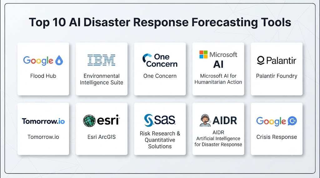
Top 10 AI Disaster Response Forecasting Tools
1. Google Flood Hub
Best for: AI-powered flood forecasting and flood-risk monitoring.
Google Flood Hub is designed specifically around flood forecasting. It combines hydrological and inundation modeling with environmental and geographic information to provide flood forecasts and related visualization.
Key Features
- AI flood forecasting
- River-level forecasting
- Flood inundation information
- Geographic visualization
- Flood-risk monitoring
- Forecast information
- Large-scale coverage
AI Capabilities
- Machine-learning forecasting
- Hydrological modeling
- Inundation modeling
- Environmental data analysis
- Predictive analytics
Pros
- Strong focus on flood forecasting
- Accessible information
- Advanced AI research
- Useful geographic visualization
- Suitable for large-scale monitoring
Cons
- Primarily focused on flooding
- Not a complete emergency command platform
- Advanced organizational integrations may require additional systems
Best Use Cases
- Flood preparedness
- Government agencies
- Humanitarian organizations
- Research
- Community flood awareness
2. National Database for Emergency Management
Best for: Multi-hazard disaster management and geospatial intelligence in India.
The National Database for Emergency Management provides disaster-related geospatial information and decision-support capabilities.
It brings together information relevant to multiple hazards and supports disaster preparedness, response, hazard assessment, and damage assessment.
Key Features
- Multi-hazard monitoring
- Flood forecasting
- Cyclone tracking
- Landslide information
- Forest-fire information
- Lightning information
- Geospatial analysis
- Disaster decision support
AI and Analytics Capabilities
- Predictive analytics
- Remote sensing
- GIS
- Environmental modeling
- Hazard analysis
- Geospatial intelligence
Pros
- Broad disaster coverage
- Strong geospatial capabilities
- Useful for government operations
- Supports multiple disaster types
Cons
- Primarily focused on India
- Access may be designed around authorized organizations
- Not a typical commercial SaaS application
Best Use Cases
- Government agencies
- Disaster-management authorities
- Emergency-response organizations
- Geospatial teams
3. MICHAEL
Best for: Global disaster intelligence and humanitarian response.
MICHAEL provides disaster-related intelligence and forecasting capabilities for organizations involved in humanitarian and emergency response.
The platform combines disaster information, forecasting, monitoring, and operational intelligence.
Key Features
- Disaster monitoring
- Flood forecasting
- Crisis intelligence
- Humanitarian information
- Disaster alerts
- Operational dashboards
- Field information
- Response support
AI Capabilities
- Predictive modeling
- Disaster analysis
- Automated information processing
- Geospatial analysis
Pros
- Global focus
- Useful for humanitarian organizations
- Combines forecasting and crisis information
- Supports operational decision-making
Cons
- Broad platform scope
- Some capabilities may require organizational implementation
- Pricing may vary based on deployment
Best Use Cases
- NGOs
- Humanitarian organizations
- Disaster-response teams
- International organizations
4. Ladris
Best for: Disaster modeling, evacuation planning, and emergency preparedness.
Ladris focuses on disaster intelligence and scenario modeling, including evacuation planning and hazard analysis.
Key Features
- Wildfire modeling
- Flood modeling
- Evacuation modeling
- Scenario simulation
- Population analysis
- Emergency planning
- Risk visualization
AI Capabilities
- Predictive modeling
- Scenario analysis
- Geospatial modeling
- Population movement analysis
Pros
- Strong evacuation capabilities
- Useful for emergency planning
- Supports scenario modeling
- Good geographic analysis
Cons
- More specialized than general disaster platforms
- Requires planning expertise
- Pricing varies by implementation
Best Use Cases
- Emergency planners
- Municipalities
- Wildfire preparedness
- Evacuation planning
5. DASTAA
Best for: Anticipatory action, vulnerability assessment, and geospatial risk analysis.
DASTAA focuses on data-driven disaster preparedness and anticipatory action.
The platform combines geospatial information, remote sensing, risk assessment, and localized communication.
Key Features
- GeoAI
- Risk assessment
- Vulnerability analysis
- Remote sensing
- Early-action planning
- Localized alerts
- Community-level analysis
- Geospatial dashboards
AI Capabilities
- GeoAI
- Predictive analysis
- Risk modeling
- Data-driven decision support
Pros
- Strong anticipatory-action focus
- Useful for community-level planning
- Combines risk and vulnerability information
- Supports geospatial analysis
Cons
- Not primarily an emergency dispatch platform
- Requires suitable geospatial data
- Implementation requirements can vary
Best Use Cases
- Humanitarian organizations
- Local governments
- Climate-risk programs
- Disaster preparedness
6. iResponse
Best for: End-to-end emergency and disaster-management operations.
iResponse combines disaster forecasting, GIS, resource management, incident management, and emergency response workflows.
Key Features
- Disaster prediction
- GIS situational awareness
- Resource management
- Incident management
- Shelter management
- Field applications
- Emergency communication
- Real-time monitoring
AI Capabilities
- Predictive analytics
- AI-based risk assessment
- Data analysis
- Automated information processing
Pros
- Broad disaster-management capabilities
- Strong GIS functionality
- Supports operational workflows
- Useful for government organizations
Cons
- Implementation can be complex
- Requires integration with existing systems
- Enterprise deployment may require specialized expertise
Best Use Cases
- Government agencies
- Emergency-management organizations
- Large disaster-response teams
7. KAJO GEO-Explorer
Best for: Geospatial disaster intelligence and Earth-observation analysis.
GEO-Explorer provides geospatial tools for environmental monitoring, disaster response, climate resilience, and damage assessment.
Key Features
- Disaster WebGIS
- Flood monitoring
- Wildfire monitoring
- Earthquake information
- Satellite imagery
- Sensor integration
- Damage assessment
- Geospatial analysis
AI Capabilities
- GeoAI
- Image analysis
- Environmental modeling
- Spatial analytics
- Risk assessment
Pros
- Strong geospatial capabilities
- Supports multiple data sources
- Useful for disaster analysts
- Good Earth-observation integration
Cons
- Requires GIS expertise
- More specialized than general emergency-management platforms
- Advanced capabilities may require configuration
Best Use Cases
- Disaster analysts
- Geospatial teams
- Climate-risk organizations
- Government agencies
8. Microsoft Azure AI
Best for: Organizations building customized disaster forecasting applications.
Microsoft Azure provides cloud AI, machine learning, analytics, data engineering, IoT, and application-development services that can be combined to build disaster forecasting solutions.
Key Features
- Machine learning
- Predictive analytics
- Computer vision
- Data processing
- IoT integration
- Geospatial applications
- AI development
- Enterprise APIs
AI Capabilities
- Machine-learning models
- Custom predictive models
- Computer vision
- Generative AI
- Predictive analytics
- Automated data processing
Pros
- Highly flexible
- Strong enterprise ecosystem
- Suitable for custom applications
- Scalable cloud infrastructure
- Extensive AI capabilities
Cons
- Requires technical expertise
- Not a ready-made disaster-management product
- Architecture and costs can become complex
Best Use Cases
- Technology companies
- Government technology teams
- Research organizations
- Enterprises building custom forecasting systems
9. Google Cloud AI
Best for: Large-scale environmental and geospatial AI development.
Google Cloud provides AI, machine learning, data analytics, geospatial technologies, and cloud infrastructure that can be used to develop custom disaster forecasting applications.
Key Features
- Machine learning
- AI development
- Geospatial analytics
- Environmental data processing
- Satellite data processing
- Predictive analytics
- Data engineering
- Cloud APIs
AI Capabilities
- Machine learning
- Computer vision
- Predictive modeling
- Geospatial AI
- Generative AI
- Large-scale data processing
Pros
- Strong AI ecosystem
- Excellent scalability
- Powerful data-processing capabilities
- Suitable for custom disaster applications
Cons
- Requires engineering expertise
- Not a turnkey disaster-response platform
- Cloud costs depend on usage and architecture
Best Use Cases
- Research organizations
- Government technology teams
- Enterprises
- Environmental AI developers
10. IBM Environmental Intelligence Suite
Best for: Enterprise environmental risk intelligence and predictive analytics.
IBM Environmental Intelligence technologies help organizations analyze environmental conditions and understand how weather and climate-related events may affect operations.
Key Features
- Environmental intelligence
- Weather analytics
- Predictive analytics
- Risk assessment
- Environmental monitoring
- Enterprise analytics
- Data integration
- Operational intelligence
AI Capabilities
- Predictive analytics
- Machine learning
- AI-assisted analysis
- Environmental data processing
Pros
- Enterprise-focused
- Strong analytics capabilities
- Useful for environmental risk management
- Integrates with business systems
Cons
- More enterprise-risk focused than emergency dispatch
- Requires configuration
- Pricing varies
Best Use Cases
- Large enterprises
- Infrastructure operators
- Utilities
- Environmental risk teams
Comparison of Top 10 Tools
| Tool | Best For | Main Strength | Deployment | AI Capability |
|---|---|---|---|---|
| Google Flood Hub | Flood forecasting | Flood prediction | Cloud/Public | High |
| National Database for Emergency Management | Indian disaster management | Multi-hazard GIS | Government platform | High |
| MICHAEL | Humanitarian intelligence | Global disaster monitoring | Cloud | High |
| Ladris | Evacuation planning | Scenario modeling | Cloud | High |
| DASTAA | Anticipatory action | Risk and vulnerability analysis | Web/GIS | High |
| iResponse | Emergency management | End-to-end disaster operations | Enterprise | High |
| KAJO GEO-Explorer | Geospatial intelligence | Earth observation | WebGIS | High |
| Microsoft Azure AI | Custom solutions | AI flexibility | Cloud/Hybrid | Very High |
| Google Cloud AI | Environmental AI | AI and geospatial ecosystem | Cloud | Very High |
| IBM Environmental Intelligence Suite | Enterprise risk | Environmental analytics | Cloud/Hybrid | High |
Scoring and Evaluation
The following scores are comparative estimates based on general capabilities, flexibility, disaster-management usefulness, integration potential, and operational suitability. They are not independent vendor benchmarks.
| Tool | Overall Score | AI Capability | GIS | Forecasting | Integrations | Enterprise Suitability |
|---|---|---|---|---|---|---|
| Google Flood Hub | 8.8/10 | 9/10 | 9/10 | 10/10 | 8/10 | 8/10 |
| National Database for Emergency Management | 9.0/10 | 8/10 | 10/10 | 10/10 | 9/10 | 10/10 |
| MICHAEL | 8.2/10 | 8/10 | 9/10 | 9/10 | 8/10 | 8/10 |
| Ladris | 8.7/10 | 9/10 | 9/10 | 9/10 | 9/10 | 9/10 |
| DASTAA | 8.2/10 | 9/10 | 9/10 | 8/10 | 8/10 | 8/10 |
| iResponse | 8.9/10 | 9/10 | 10/10 | 9/10 | 10/10 | 10/10 |
| KAJO GEO-Explorer | 8.2/10 | 8/10 | 10/10 | 8/10 | 9/10 | 8/10 |
| Microsoft Azure AI | 8.8/10 | 10/10 | 9/10 | Custom | 10/10 | 10/10 |
| Google Cloud AI | 8.8/10 | 10/10 | 10/10 | Custom | 10/10 | 10/10 |
| IBM Environmental Intelligence Suite | 8.5/10 | 9/10 | 9/10 | 9/10 | 10/10 | 10/10 |
Best AI Disaster Response Forecasting Tools by Use Case
Best for Flood Forecasting
Google Flood Hub
It is highly focused on flood forecasting and provides a strong option for organizations primarily concerned with river and flood risk.
Best for Multi-Hazard Government Operations
National Database for Emergency Management
It provides broad disaster-related geospatial capabilities and is particularly relevant to Indian disaster-management operations.
Best for Humanitarian Organizations
MICHAEL
Its focus on disaster intelligence and humanitarian response makes it suitable for organizations working across multiple crisis environments.
Best for Evacuation Planning
Ladris
Its scenario modeling and evacuation capabilities make it particularly useful for communities and emergency planners.
Best for Anticipatory Action
DASTAA
It is well suited to organizations that want to combine risk information, vulnerability analysis, and early action.
Best for End-to-End Emergency Management
iResponse
It combines forecasting, GIS, incident management, resource management, and response workflows.
Best for Geospatial Intelligence
KAJO GEO-Explorer
Its focus on Earth observation, GIS, sensors, and disaster analysis makes it useful for geospatial teams.
Best for Custom AI Development
Microsoft Azure AI
Organizations with engineering teams can use Azure to build highly customized disaster forecasting systems.
Best for Large-Scale Geospatial AI
Google Cloud AI
It provides strong infrastructure for organizations developing advanced environmental and geospatial AI applications.
Best for Enterprise Environmental Risk
IBM Environmental Intelligence Suite
It is particularly useful for organizations connecting environmental intelligence with business and operational risk.
Which AI Disaster Response Forecasting Tool Is Right for You?
For Small Organizations
Small organizations should prioritize simplicity.
Important capabilities include:
- Reliable alerts
- Basic forecasting
- Geographic visualization
- Simple dashboards
- Affordable access
- Easy deployment
A highly customized AI platform may be unnecessary if the organization only needs basic risk information.
For Mid-Sized Organizations
Mid-sized organizations should consider:
- GIS
- Forecasting
- Risk mapping
- Exposure analysis
- Alerts
- APIs
- Historical data
- Resource planning
The objective should be to connect forecasting with actual response procedures.
For Enterprises
Large organizations should evaluate:
- Multi-hazard support
- Real-time data
- Satellite integration
- IoT
- GIS
- Predictive analytics
- Scenario simulation
- Exposure modeling
- APIs
- Security
- Governance
- Disaster recovery
Enterprises should also assess whether the system can integrate with their existing emergency-management, business-continuity, and operational systems.
For Government Agencies
Government agencies should prioritize:
- Multi-agency coordination
- Multi-hazard forecasting
- Location-specific information
- Data governance
- Interoperability
- Public warning capabilities
- Auditability
- Security
- Human oversight
- Operational reliability
For Humanitarian Organizations
Humanitarian organizations should focus on:
- Early warning
- Vulnerability analysis
- Population exposure
- Localized alerts
- Resource planning
- Field reporting
- Community communication
- Anticipatory action
For Infrastructure Operators
Infrastructure organizations should focus on impact-based forecasting.
They should determine whether a system can identify potential impacts on:
- Roads
- Bridges
- Power facilities
- Water systems
- Hospitals
- Warehouses
- Communication infrastructure
- Data centers
- Industrial facilities
Budget vs Premium Solutions
Budget Approach
Organizations with limited budgets can begin with:
- Public forecasting systems
- Open datasets
- Basic GIS tools
- Weather information
- Satellite datasets
- Simple dashboards
This approach can support basic preparedness without requiring a large technology investment.
Premium Approach
Large organizations may require:
- Multi-hazard forecasting
- High-resolution GIS
- Scenario simulation
- IoT integration
- Automated alerts
- Exposure modeling
- Resource management
- Damage assessment
- Enterprise APIs
- Dedicated support
- Advanced security
The additional investment is most valuable when forecasting information is directly connected to operational decision-making.
Build vs Buy
Build
Building a custom disaster forecasting platform may make sense when an organization:
- Has a strong AI team
- Has specialized historical datasets
- Needs a highly specialized model
- Requires complete control
- Has unique geographic requirements
- Needs custom integrations
Buy
Buying an established solution may be preferable when an organization:
- Needs deployment quickly
- Has limited AI expertise
- Requires established workflows
- Needs vendor support
- Wants mature integrations
- Does not want to maintain forecasting infrastructure
Hybrid Approach
A hybrid model can combine commercial disaster-management platforms with internally developed AI models.
For example, an organization might use an established platform for:
- GIS
- Alerts
- Dashboards
- Data integration
- Incident management
while using proprietary models for specialized flood, wildfire, or infrastructure-risk forecasting.
Common Mistakes and How to Avoid Them
Treating Predictions as Certainty
AI forecasts contain uncertainty.
Organizations should communicate forecast confidence clearly.
Ignoring Data Quality
Poor-quality sensor, weather, satellite, or historical data can reduce model performance.
Ignoring False Positives
Too many unnecessary warnings can reduce public and operational trust.
Ignoring False Negatives
Missing a serious disaster event can have severe consequences.
Using AI Without Domain Experts
Disaster forecasting requires knowledge of meteorology, hydrology, geography, emergency management, infrastructure, and local conditions.
Assuming One Model Works Everywhere
A model trained in one geographic region may not perform equally well in another.
Ignoring Data Latency
A forecast that arrives too late may have limited operational value even if the prediction is accurate.
Depending on a Single Data Source
Weather systems, sensors, satellites, and communication networks can fail.
Multiple data sources can improve resilience.
Ignoring Model Governance
Organizations should know:
- Which model generated the prediction
- Which data was used
- When the model was updated
- How accurate previous forecasts were
Over-Automating Decisions
AI should support emergency professionals rather than blindly making high-consequence decisions.
Weak Cybersecurity
Disaster-management systems can contain critical operational information and therefore require strong security controls.
FAQs
What are AI Disaster Response Forecasting Tools?
They are AI-powered platforms that analyze environmental, geographic, weather, satellite, sensor, and historical data to forecast disaster risks and support emergency planning.
What types of disasters can AI forecast?
Depending on the system, AI can support flood, wildfire, cyclone, storm, drought, landslide, extreme heat, and other hazard forecasting.
Can AI accurately predict floods?
AI can provide useful flood forecasts, particularly when combined with high-quality hydrological, weather, terrain, and river data. Accuracy varies by location and forecast horizon.
Can AI predict earthquakes?
Earthquake prediction remains a major scientific challenge. AI is more commonly used for seismic monitoring, detection, risk assessment, and post-event analysis than reliable prediction of future earthquakes.
How far ahead can disaster forecasting tools predict events?
The forecast horizon depends on the hazard. Some weather-related hazards can be forecast days ahead, while rapidly developing events may only provide useful warnings hours or minutes in advance.
Can AI use satellite imagery?
Yes. Satellite imagery can support flood mapping, wildfire detection, damage assessment, environmental monitoring, and other disaster-related applications.
Can AI help with evacuation planning?
Yes. AI and simulation systems can analyze hazard areas, population movement, transportation networks, traffic, and shelters to support evacuation planning.
Can AI automatically send emergency warnings?
Some systems can support automated alerting, but emergency organizations should establish appropriate thresholds, verification procedures, escalation rules, and human oversight.
What data is required for AI disaster forecasting?
Common data sources include weather observations, satellite imagery, rainfall, river levels, radar, terrain, historical disaster records, population information, infrastructure data, and IoT sensors.
How much do AI disaster forecasting tools cost?
Costs vary significantly. Public forecasting services may be free, while enterprise platforms can involve licensing, implementation, data, infrastructure, integration, and support costs.
Can these tools predict disaster damage?
Some systems can estimate potential damage by combining hazard forecasts with information about buildings, roads, utilities, population, and other exposed assets.
Are AI disaster forecasts always reliable?
No. AI forecasts can be affected by incomplete data, changing environmental conditions, model limitations, sensor failures, and uncertainty. They should be evaluated and interpreted carefully.
Do disaster forecasting tools support real-time monitoring?
Many modern platforms provide near-real-time monitoring and updates. The actual update speed depends on available data and the underlying technology.
Can organizations build their own AI disaster forecasting system?
Yes. Organizations with suitable data-science, GIS, cloud, and disaster-management expertise can build customized forecasting systems using machine learning and environmental data.
Is human oversight necessary?
Yes. Human oversight remains important because disaster forecasting involves uncertainty and potentially high-consequence decisions.
Conclusion
AI Disaster Response Forecasting Tools are becoming an important part of modern disaster preparedness and emergency management.They can help organizations analyze massive amounts of information, identify changing risk, forecast hazards, understand population and infrastructure exposure, support evacuation planning, allocate resources, and assess damage.Google Flood Hub is highly specialized in flood forecasting. The National Database for Emergency Management provides broad disaster-related geospatial capabilities in India. MICHAEL focuses on disaster intelligence and humanitarian applications, while Ladris is particularly useful for evacuation and scenario modeling. DASTAA emphasizes anticipatory action and vulnerability analysis, while iResponse connects forecasting with broader emergency-management workflows.Geospatial platforms such as KAJO GEO-Explorer can provide strong Earth-observation capabilities, while Microsoft Azure AI and Google Cloud AI offer flexible foundations for organizations developing customized disaster forecasting solutions. IBM’s environmental intelligence capabilities are particularly relevant to enterprises interested in environmental and operational risk.